-
Which the release of FS2020 we see an explosition of activity on the forun and of course we are very happy to see this. But having all questions about FS2020 in one forum becomes a bit messy. So therefore we would like to ask you all to use the following guidelines when posting your questions:
- Tag FS2020 specific questions with the MSFS2020 tag.
- Questions about making 3D assets can be posted in the 3D asset design forum. Either post them in the subforum of the modelling tool you use or in the general forum if they are general.
- Questions about aircraft design can be posted in the Aircraft design forum
- Questions about airport design can be posted in the FS2020 airport design forum. Once airport development tools have been updated for FS2020 you can post tool speciifc questions in the subforums of those tools as well of course.
- Questions about terrain design can be posted in the FS2020 terrain design forum.
- Questions about SimConnect can be posted in the SimConnect forum.
Any other question that is not specific to an aspect of development or tool can be posted in the General chat forum.
By following these guidelines we make sure that the forums remain easy to read for everybody and also that the right people can find your post to answer it.
You are using an out of date browser. It may not display this or other websites correctly.
You should upgrade or use an alternative browser.
You should upgrade or use an alternative browser.
P3D v4 Florida Photoreal Project
- Thread starter Alex753
- Start date
MatthiasKNU
Resource contributor
- Messages
- 960
- Country
-

Florida is US...
MatthiasKNU
Resource contributor
- Messages
- 960
- Country
-
No, the Microsoft Building shapefiles only include the US and Canada
MatthiasKNU
Resource contributor
- Messages
- 960
- Country
-
It goes on, here is a screenshot of the newly created Landuse Shapefile and the buildings (Palm Beach):
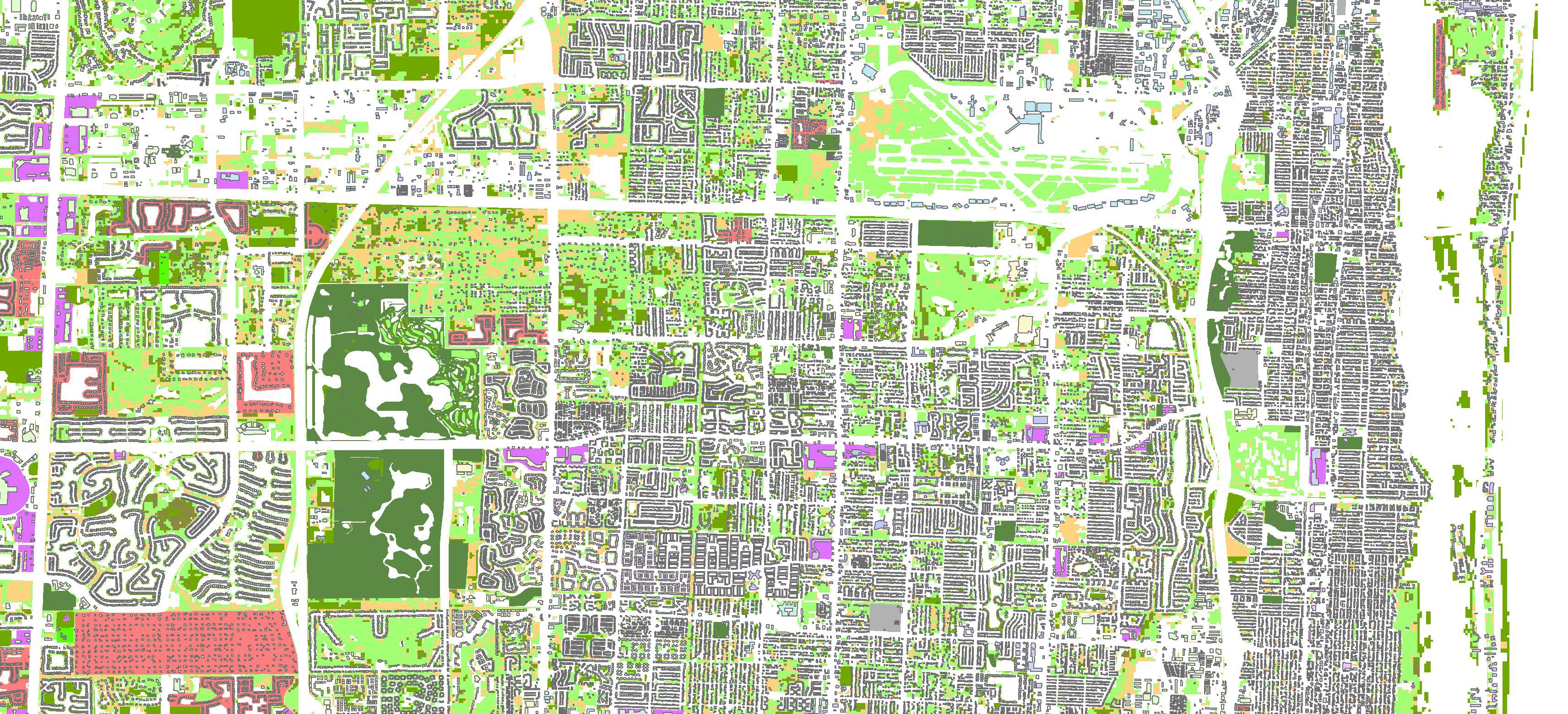
I think until tomorrow the landuse shapefile will be complete...
I think until tomorrow the landuse shapefile will be complete...
- Messages
- 283
- Country
-

This is incredibly rich of datas !
How do you divide your work ?
Like do you work city by city or by big squares like I do ?
However i’m almost reaching cap Canaveral, there is not too much cloud and colorimetry is pretty good in this area.
Project is going forward, nice and thanks !
How do you divide your work ?
Like do you work city by city or by big squares like I do ?
However i’m almost reaching cap Canaveral, there is not too much cloud and colorimetry is pretty good in this area.
Project is going forward, nice and thanks !
MatthiasKNU
Resource contributor
- Messages
- 960
- Country
-
I have tiled approach, I created a dynamic fishnet for the whole state, splitting all the data in rectangles.
- Messages
- 5,214
West Palm Beach I supposeIt goes on, here is a screenshot of the newly created Landuse Shapefile and the buildings (Palm Beach):
 ?
?MatthiasKNU
Resource contributor
- Messages
- 960
- Country
-
Can't tell you that... I looked up the coordinates, entered them in Google... and google says "Palm Beach"
MatthiasKNU
Resource contributor
- Messages
- 960
- Country
-
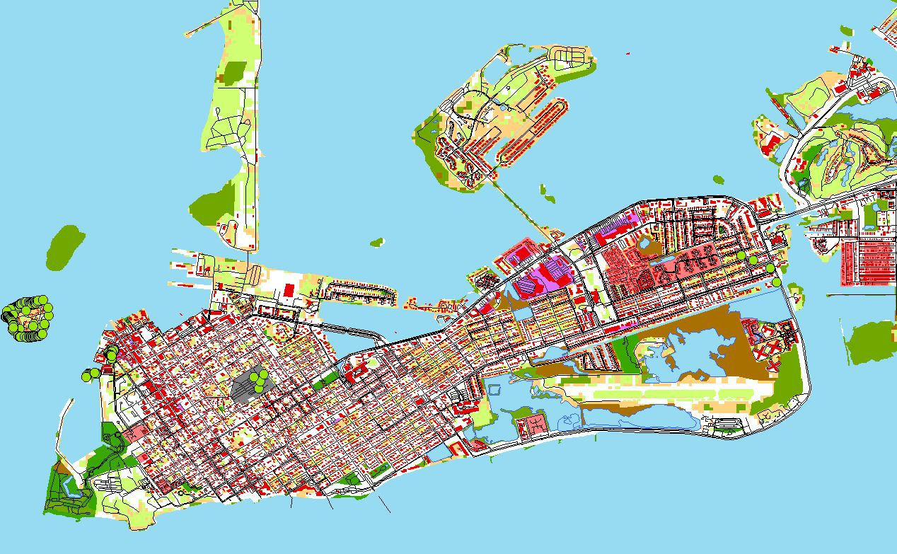
Another screenshot from ArcGIS:
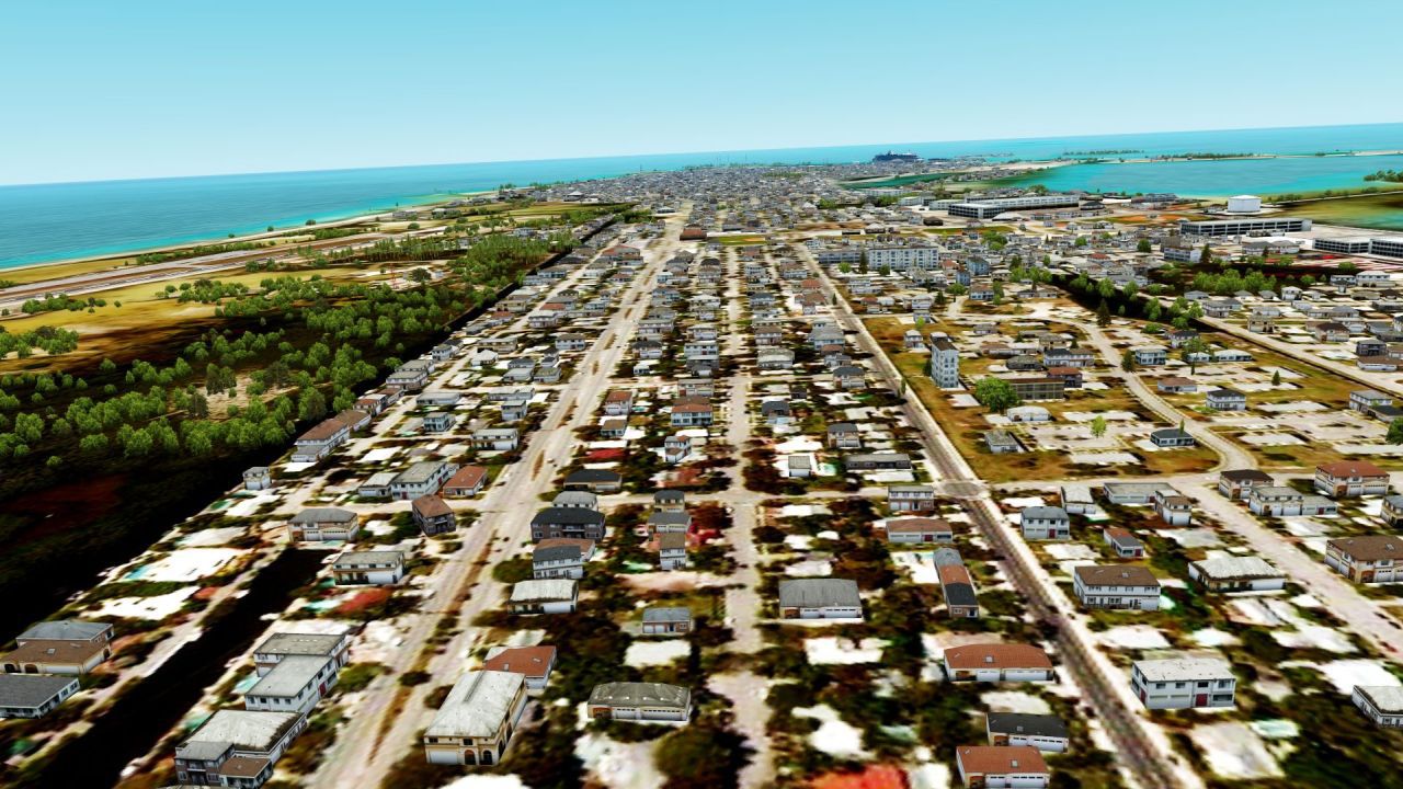
Key West:
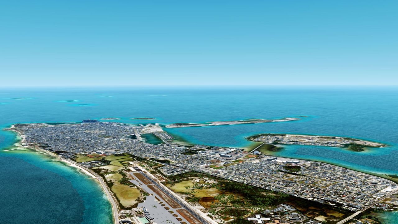
All the data for Florida is now ready to be optimized for autogen creation.
Key West:
All the data for Florida is now ready to be optimized for autogen creation.
MatthiasKNU
Resource contributor
- Messages
- 960
- Country
-
You'll hardly notice a difference to the default scenery.Oh my CPU can create the autogens but can never run them in P3D
MatthiasKNU
Resource contributor
- Messages
- 960
- Country
-
Autogen is complete!
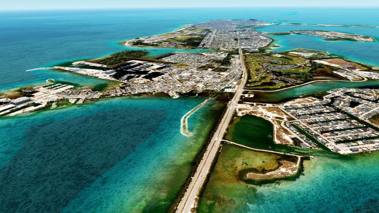
Have a nice weekend everybody!
Have a nice weekend everybody!