-
Which the release of FS2020 we see an explosition of activity on the forun and of course we are very happy to see this. But having all questions about FS2020 in one forum becomes a bit messy. So therefore we would like to ask you all to use the following guidelines when posting your questions:
- Tag FS2020 specific questions with the MSFS2020 tag.
- Questions about making 3D assets can be posted in the 3D asset design forum. Either post them in the subforum of the modelling tool you use or in the general forum if they are general.
- Questions about aircraft design can be posted in the Aircraft design forum
- Questions about airport design can be posted in the FS2020 airport design forum. Once airport development tools have been updated for FS2020 you can post tool speciifc questions in the subforums of those tools as well of course.
- Questions about terrain design can be posted in the FS2020 terrain design forum.
- Questions about SimConnect can be posted in the SimConnect forum.
Any other question that is not specific to an aspect of development or tool can be posted in the General chat forum.
By following these guidelines we make sure that the forums remain easy to read for everybody and also that the right people can find your post to answer it.
You are using an out of date browser. It may not display this or other websites correctly.
You should upgrade or use an alternative browser.
You should upgrade or use an alternative browser.
How to change a photoreal images 'scale' (increase size)
- Thread starter Ols500
- Start date
- Status
- Not open for further replies.

Hi Ollie:
It is essential to NOT scale imagery or change total pixel Rows / Columns ...to keep existing Geo-referencing correct.
IIUC, you are trying to change the size of ONLY a road within the photo-real imagery.
If so, this can be done in ex: Photoshop with a copy of the original imagery file by selecting the road with ex: the Magic Wand tool, copying it, and pasting it into position as a floating selected object, and re-scaling that object ONLY.
That scaled floating object can then be 'merged' / 'flattened' into the background image.
Please let me know if I have understood your goal correctly.")
GaryGB
It is essential to NOT scale imagery or change total pixel Rows / Columns ...to keep existing Geo-referencing correct.
IIUC, you are trying to change the size of ONLY a road within the photo-real imagery.
If so, this can be done in ex: Photoshop with a copy of the original imagery file by selecting the road with ex: the Magic Wand tool, copying it, and pasting it into position as a floating selected object, and re-scaling that object ONLY.
That scaled floating object can then be 'merged' / 'flattened' into the background image.
Please let me know if I have understood your goal correctly.
GaryGB
Last edited:
https://www.fsdeveloper.com/forum/t...images-scale-increase-size.445452/post-822953
Hi Gary, I actually mean the image is out of proportion in comparison with the rest of the scenery. So yep I would like to actually scale the image.
Thanks.
Hi Ollie:
Could you please explain what you mean by: "the image is out of proportion in comparison with the rest of the scenery" ?
By "rest of the scenery", are you referring to surrounding artificial land class tiles provided by OrbX FTX Global ?
If you would please post a screenshot of where you are seeing the mis-match of imagery proportions you reported above, I would be glad to offer more more task-specific observations / suggestions ex: on how to better integrate your custom photo-real land class imagery BGL into the underlying surrounding artificial land class tiles provided by OrbX FTX Global.
GaryGB
- Messages
- 155
- Country
-

Hi Gary,
What I'm trying to say is the image looks too small, so objects like the hanger look too small compared to the glider. The hanger should be roughly x2 the size. This also makes the airfield smaller than it should be. BTW I have now blended the image, looks great!
.png")
As you can see the hanger is too small for the glider so it looks out of proportion.
Also, here is the road. The road provided by Orbx vector is the correct width, while the photoreal image is too small, about 1/2 the size.

Thanks, Ollie.
What I'm trying to say is the image looks too small, so objects like the hanger look too small compared to the glider. The hanger should be roughly x2 the size. This also makes the airfield smaller than it should be. BTW I have now blended the image, looks great!
As you can see the hanger is too small for the glider so it looks out of proportion.
Also, here is the road. The road provided by Orbx vector is the correct width, while the photoreal image is too small, about 1/2 the size.
Thanks, Ollie.
Hi Ollie:
I see what you are referring to now.
I'll have to think about this scenario for a bit before I reply with a suggestion to try, as I have not yet encountered this apparent inaccurate 'sizing' / 'scaling' issue with imagery from any online tile-servers ...processed via SBuilderX.
Did you manually edit any Geo-referencing or pixel dimension parameter values in the *.INF file before compiling ?
BTW: Which user aircraft 'glider' are you piloting in the FS screenshot above ?
< Yup... I want to verify the wing-span size to identify what imagery sizes we are seeing there locally in FS at run time >
GaryGB
Last edited:
- Messages
- 155
- Country
-
Hi,
"Did you manually edit any Geo-referencing or pixel dimension parameter values in the *.INF file before compiling "
No I did not this is my INF file:
[Source]
Type = MultiSource
NumberOfSources = 2
[Source1]
Type = BMP
Layer = Imagery
SourceDir = "E:\P3D\Addon Scenery\Southdown Gliding Club\Files"
SourceFile = "SDG.bmp"
Variation = January, February, March, April, May, June, July, August, September, October, November, December
Channel_BlendMask = 2.0
Channel_LandWaterMask = 2.0
ulyMap = 50.9307380237183
ulxMap = -.4833984375
xDim = 2.68220901489203E-06
yDim = 1.69069188178127E-06
[Source2]
Type = BMP
Layer = None
SourceDir = "E:\P3D\Addon Scenery\Southdown Gliding Club\Files"
SourceFile = "SDG_Blendmask.bmp"
SamplingMethod = Gaussian
ulyMap = 50.9307380237183
ulxMap = -.4833984375
xDim = 2.68220901489203E-06
yDim = 1.69069188178127E-06
[Destination]
DestDir = "E:\P3D\Addon Scenery\Southdown Gliding Club\Files"
DestBaseFileName = "SDG-Final"
DestFileType = BGL
LOD = 6,Auto
UseSourceDimensions = 1
CompressionQuality = 100
I am using the "K21" roughly a wingspan of 17meters.
Hi Ollie:
Google Earth 'Ruler' tool: Schleicher ASK 21 glider wingspan in the upper image correlates with the Google Earth 3D and 'real' world size.
https://en.wikipedia.org/wiki/Schleicher_ASK_21#Specifications_(ASK_21)
https://www.aerosoft.com/us/flight-simulation/flight-simulator-x-steam/aircraft/1204/ask21-ask21-mi
https://www.fsglider.de/p_e.htm
https://www.rikoooo.com/downloads/viewdownload/67/320
The same appears to also be true for the hangar size; are you certain that hangar is used for a non-disassembled glider ?
What are the Geographic coordinates of the "mis-matched" road sizes seen in the bottom image that you attached to your post above ?
GaryGB
Last edited:
- Messages
- 155
- Country
-
Yes I am certain as I go the club.are you certain that hanger is used for a non-disassembled glider
Do you mean long/lat?What are the Geographic coordinates of the "mis-matched" road sizes seen in the bottom image that you attached to your post above ?
https://www.fsdeveloper.com/forum/t...images-scale-increase-size.445452/post-822987
Hi Ollie:
Google Earth 'Ruler' tool: Schleicher ASK 21 glider wingspan in the upper image correlates with the Google Earth 3D and 'real' world size.
https://en.wikipedia.org/wiki/Schleicher_ASK_21#Specifications_(ASK_21)
https://www.aerosoft.com/us/search?sSearch=K21
The same appears to also be true for the hangar size; are you certain that hanger is used for a non-disassembled glider ?
https://www.fsdeveloper.com/forum/t...images-scale-increase-size.445452/post-822988
Yes I am certain as I go (to) the club.
Hmmm... I will have to do some further inquiry on this "scale" scenario via SBuilderX and my GIS application for a few minutes.
https://www.fsdeveloper.com/forum/t...images-scale-increase-size.445452/post-822987
What are the Geographic coordinates of the "mis-matched" road sizes seen in the bottom image that you attached to your post above ?
GaryGB
Yes, please; Geographic coordinates in Latitude and Longitude ...from either SBuilderX or Google Earth.
GaryGB
Hi Ollie:
GIS application shows same size as Google Earth for the above cited Southdown Glider Club hangar in ESRI World Imagery.
Which tileserver did you use in SBuilderX for your custom photo-real imagery land class BGL shown in your attached screenshots above ?
Also, please confirm whether you have more local add-ons than just OrbX FTX Global Base Pack installed.
Specifically, I'd like to know if you also have installed:
OrbX FTX Global Vector
OrbX FTX Global openLC Europe
OrbX FTX EU England
OrbX FTX EGHR Chichester / Goodwood Airport
Flight1 Scenery Solutions Ultimate Terrain X Europe
...or:
Any other 3rd party (payware or freeware) add-on providing land class textures and/or CVX vector Roads that cover this local area.
GaryGB
Last edited:
- Messages
- 155
- Country
-
Hi Gary,
All of those.
I used 'virtualEarthSatelilte'
Thanks.
OrbX FTX Global Vector
OrbX FTX Global openLC Europe
OrbX FTX EU England
All of those.
Which tileserver did you use in SBuilderX for your custom photo-real imagery land class BGL shown in your attached screenshots above ?
I used 'virtualEarthSatelilte'
I only use Orbxs' stuff.Flight1 Scenery Solutions Ultimate Terrain X Europe
...or:
Any other 3rd party add-on providing land class textures and/or CVX vector Roads
Thanks.
Hi Ollie:
GIS application in ESRI World Imagery shows same size as Google Earth and SBuilderX in 'VirtualEarthSatellite'.
The FTX Global vector is AFAIK, intended to be accurate to the real world for Roads.
FTX Global land class textures are apparently not accurate for this location at this time.
I would suggest that you consider expanding your custom photo-real imagery coverage area outwards so the Blend Mask can be aligned with edges of Roads / landmarks in OrbX Global Vector CVX BGL data set that more closely match the imagery of 'VirtualEarthSatellite'.
Otherwise, you can 'Exclude' OrbX Global Vector CVX vector BGL (local) QMID-11 contents, and replace it with your own custom Roads, so that they align with the imagery of 'VirtualEarthSatellite'.
Feel free to let me know what your thoughts are with regard to this, as there are other options which might be considered as well.
FYI: I am making a "quick-and-dirty" 3D model of the hangar in question from Trimble imagery in Sketchup to inquire into the 'scale' issue.
I will post some results on that in a while, in this same thread.
GaryGB
- Messages
- 155
- Country
-
Hi Gary,
This seems like the best option
Otherwise, you can 'Exclude' OrbX Global Vector CVX vector BGL (local) QMID-11 contents, and replace it with your own custom Roads, so that they align with the imagery of 'VirtualEarthSatellite'.
This seems like the best option
Oh wow, thanks a lot! I have been planning to create some 3D models but got no idea how to. Is Sketchup free? If so is there a tutorial?FYI: I am making a "quick-and-dirty" 3D model of the hangar in question from Trimble imagery in Sketchup to inquire into the 'scale' issue.
Hi Ollie:
I am basing the "Q+D" Sketchup 3D model of Southdown Glider Club's large hangar on this image from their website:
https://www.southdowngliding.co.uk/wp-content/uploads/2019/05/hangar-1-1030x639.jpg
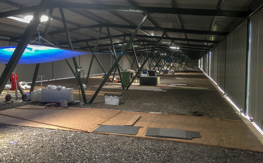
I have estimated that hangar's real world size to be: 15 Meters Wide x 25 Meters Long x 4.5 Meters Height at roof peak
Apparently the Glider bays are on the sides, each with double sliding doors for each adjacent pair of bays ?
[EDITED]
Info on another website stated the intended Southdown large hangar capacity was 18 gliders ?
https://uk.linkedin.com/in/craig-lowrie-17909510
That would be 2.7777777777777777777777777777778 Meters for each Glider bay width ...along each of the (2) hangar sides.
IIUC, that means Glider wings must be stowed before backed into bays.
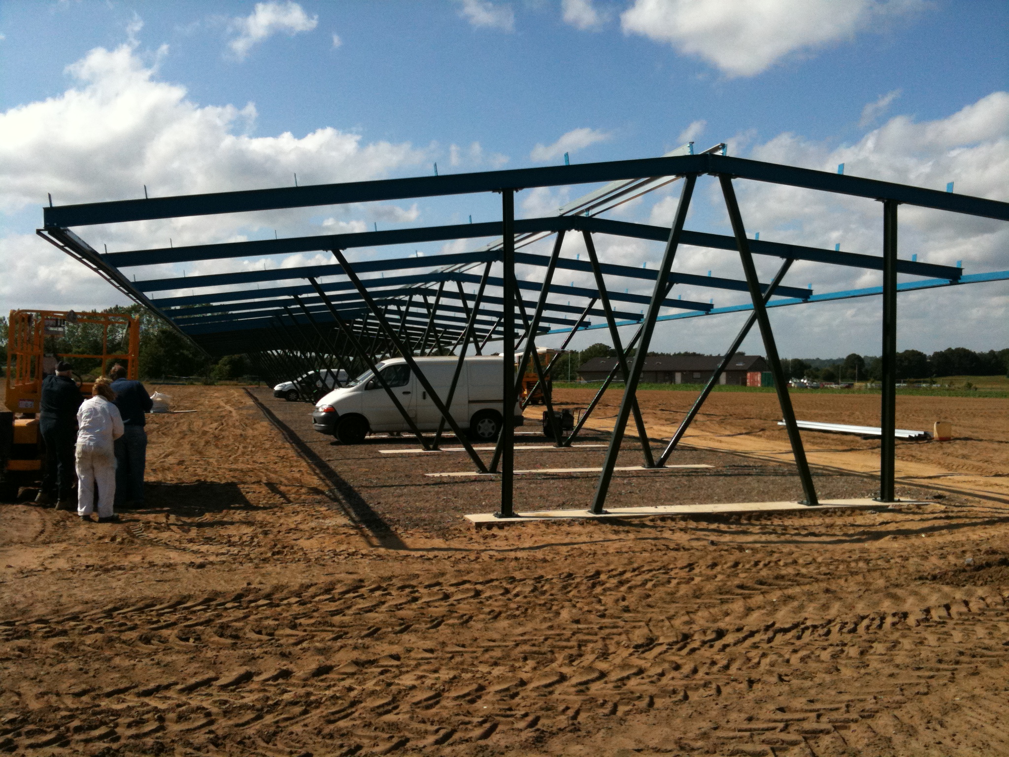
I'm not yet sure how that correlates with structural supports shown in the above image ...and this one:
[END_EDIT]
More info to come shortly on Sketchup.
GaryGB
I am basing the "Q+D" Sketchup 3D model of Southdown Glider Club's large hangar on this image from their website:
https://www.southdowngliding.co.uk/wp-content/uploads/2019/05/hangar-1-1030x639.jpg
I have estimated that hangar's real world size to be: 15 Meters Wide x 25 Meters Long x 4.5 Meters Height at roof peak
Apparently the Glider bays are on the sides, each with double sliding doors for each adjacent pair of bays ?
[EDITED]
Info on another website stated the intended Southdown large hangar capacity was 18 gliders ?
https://uk.linkedin.com/in/craig-lowrie-17909510
That would be 2.7777777777777777777777777777778 Meters for each Glider bay width ...along each of the (2) hangar sides.
IIUC, that means Glider wings must be stowed before backed into bays.
I'm not yet sure how that correlates with structural supports shown in the above image ...and this one:
[END_EDIT]
More info to come shortly on Sketchup.
GaryGB
Attachments

Last edited:
- Messages
- 155
- Country
-
Hi Gary,
Yes this is correct
Thanks, Ollie.
Apparently the Glider bays are on the sides, each with double sliding doors for each adjacent pair of bays ?
Yes this is correct
Thanks, Ollie.
- Status
- Not open for further replies.