Hi Chris:
Have you seen these web pages ?

USGS ArcGIS REST Services Directory Folder
https://basemap.nationalmap.gov/arcgis/rest/services
On QGIS 3.2 I add, through the XYZ Tiles tab in the browser, this URL: http://services.arcgisonline.com/ArcGIS/rest/services/USA_Topo_Maps/MapServer/tile/${z}/${y}/${x}.jpg All that is displayed ...

gis.stackexchange.com
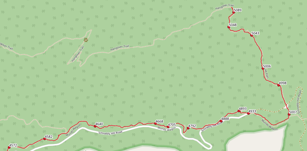
I did a lot of hiking around Sedona, Arizona a few weeks ago, and wanted to map my GPS way points and tracks in QGIS over some WMS (web mapping service) base map layers. I recently switched to QGIS…

atcoordinates.info
PS: And yes, JPEG2000 compression (aka "MrSID" format) when set at 'lossy'
really sucks.

AFAIK, USDA NAIP and USGS contracts probably do retain rights to all original full-resolution imagery by contractors who fly the DOQ grid sortees, but those are only available to us by special order for a fee on hard drives; the web portal distribution of pre-sized tile versions are 'lossy'.
IMHO, with internet distribution architecture having evolved to the point of having very fast throughput bandwidth, and with use of peer-to-peer
ex: Torrent-type technology being widespread, there is no longer an excuse for USGS and other federal agencies
et al to restrict access to full resolution original imagery via the internet.
While we 'should'
want to credit the USGS for source data,
and log into our USGS accounts at least every 6 months to keep our access 'active' for certain downloads that work around the web portal logins so they are not regarded as expired access permissions and therefore 'blocked', I do not see a rationale any longer for the apparent 'job justification' activities of USGS staffers by making us order bulk imagery at full resolution on hard drives only for a fee, as the taxpayers have already paid for the imagery acquisition and distribution budget.
Thus, they are already funded for all such work acquiring / improving data sources throughout the year.
Time for another taxpayer revolt; "
Power to the people !"


Hmmm... was that "covet" ...or 'Covid' ?
GaryGB


")