• Which the release of FS2020 we see an explosition of activity on the forun and of course we are very happy to see this. But having all questions about FS2020 in one forum becomes a bit messy. So therefore we would like to ask you all to use the following guidelines when posting your questions:

    • Tag FS2020 specific questions with the MSFS2020 tag.
    • Questions about making 3D assets can be posted in the 3D asset design forum. Either post them in the subforum of the modelling tool you use or in the general forum if they are general.
    • Questions about aircraft design can be posted in the Aircraft design forum
    • Questions about airport design can be posted in the FS2020 airport design forum. Once airport development tools have been updated for FS2020 you can post tool speciifc questions in the subforums of those tools as well of course.
    • Questions about terrain design can be posted in the FS2020 terrain design forum.
    • Questions about SimConnect can be posted in the SimConnect forum.

    Any other question that is not specific to an aspect of development or tool can be posted in the General chat forum.

    By following these guidelines we make sure that the forums remain easy to read for everybody and also that the right people can find your post to answer it.

P3D v5 Project Africa for P3Dv4/P3Dv5

And also Project Africa is compatible to P3Dv5:
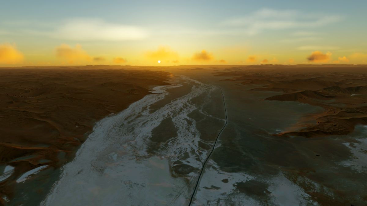
2020-4-25_8-28-38-979tjje5.jpg


2020-4-25_8-32-58-997zqkwv.jpg


2020-4-25_8-34-13-156zakaw.jpg


2020-4-25_8-36-53-684y9kno.jpg
 
As a South African , I approve,.......I approve very much...Well done.
P.s. For the life of me, I cant find the Download link?
 
Last edited:
I thought so, You must see what I pay for Satellite Imagery. I think I am at 1000 Us Dollars already, and I barley covered the area around my airport.

Yeah and you make money on it. Matthias doens't. Very poor move, you can be sure I will not buy from you again.
 
Yeah and you make money on it. Matthias doens't. Very poor move, you can be sure I will not buy from you again.

What I was trying to say is Acquiring Satellite Imagery legally in Africa, is an expensive and legally Confusing.
I have advised many people how to go through the Process legally, and it always ends up very expensive, especially in South Africa where a 100squre km of Satellite imagery costs the same as an Architect makes in a month.
Bye the way I have not sold anything yet. I haven't even decided if my airport will be freeware or payware yet.
 
Last edited:
What I was trying to say is Acquiring Satellite Imagery legally in Africa, is an expensive and legally Confusing.
Bye the way I have not sold anything yet. I haven't even decided if my airport will be freeware or payware yet.

You are legally confusing. How about convincing with your own prodcuts rather than bitching at others?
Or are you a guy who's been fired from ORBX for fucking up a payware product which looked a thousand times worse then this freeware?
People like you are the reason why there are so little good developers left. We had an excellent project here which you just ruined.

I'm looking forward to see your 1000USD photoreal freeware airport. Stupid troll.
 
You are legally confusing. How about convincing with your own prodcuts rather than bitching at others?
Or are you a guy who's been fired from ORBX for fucking up a payware product which looked a thousand times worse then this freeware?
People like you are the reason why there are so little good developers left. We had an excellent project here which you just ruined.

I'm looking forward to see your 1000USD photoreal freeware airport. Stupid troll.
I think your confused. You clearly think I am someone else.

A thousand Dollars in Photo real imagery, is a 100sqaure meters. That is what Arc GiS charges.
 
I think your confused. You clearly think I am someone else.

A thousand Dollars in Photo real imagery, is a 100sqaure meters. That is what Arc GiS charges.

All I see is a desperate developer who likes to ruin other people. Good job.
 
And I think with this post, Project Africa is also finished!
Congratulations Matthias for your great work :)whatever the outcome, the Africa challenge is done.
You should get into airport design or you will definitely have more fun;)
 
Well, as I said, even after several requests I could not find out if I could use the satellite images for this purpose.
I only got an offer for a commercial use (14-18 €/sqkm). I don't intend to do that. I use the satellite images exclusively for non-commercial purposes.

For commercial products you usually need an expensive commercial use license - like you do for your airfield.

For non-commercial products, US providers have fair use guidelines. The provider from which the pictures are taken does not - although it is a US company.

So this is simply a grey area, in my opinion.
 
Last edited:
  • Like
Reactions: Emi
Congratulations Matthias for your great work :)whatever the outcome, the Africa challenge is done.
You should get into airport design or you will definitely have more fun;)
Thanks!

Well, unfortunately I have no talent as a modeler, I have tried it several times, and always gave up... Otherwise there would have been a few airfields from me :cool:
 
And yeah, that's what they charge for a payware airport. For freeware, you can use it for free: https://www.google.com/permissions/geoguidelines/
Emi, those terms and conditions are for using Google Earth or Google Maps presentations on a website, not for use of the underlying geodata. In fact, it expressly forbids using their output to reconstruct 3D models.

Matthias is wise to be cautious. Without an express permission to use whatever geodata source he uses, it's possible he could be in serious difficulties. I don't think it's appropriate to give a hard time to those who point out what it potentially costs to use this data legally.
 
And yeah, that's what they charge for a payware airport. For freeware, you can use it for free: https://www.google.com/permissions/geoguidelines/

No, not how it works. Not at all. Arch GIS owns all South African Satellite Images, That Google terms of Service only covers the API for a web service, not the actual Data.
This has been discussed at lengths on this Forum.

1588583840639.png


1588583886063.png


1588583918452.png


See the Owner of the Data at the Bottom?
1588583736642.png


Do you realy thinks that I like spending money that I don't have to buy Imagery?
So please don't accuse me of being the problem, when I am just following the rules.

MatthiasKNU put his heart and soul into something incredible, that i would gladly spend money on.
 

Attachments

  • 1588583629049.png
    1588583629049.png
    1.4 MB · Views: 264
In fact, it expressly forbids using their output to reconstruct 3D models.
Well, I don't do that.
I am creating a photoscenery, just to be able to show my autogen above it...
I am not reconstructing 3D models based on satellite imagery.
 
MatthiasKNU put his heart and soul into something incredible, that i would gladly spend money on.
Well, that's nice, for whole of Africa it would cost around 480 Millions of Euros to license the imagery for commercial use.
 
Well, that's nice, for whole of Africa it would cost around 480 Millions of Euros to license the imagery for commercial use.


At that Price you could buy yourself your 7 favorite Airplanes and tour Africa for the rest of your life. LOL
If your ever in South Africa, we can rent an Airplane and take our own damn Photos. Lol .

In all honesty, I am just as impressed by you scenery as I am by the tools you created to process you images.
 
Back
Top