• Which the release of FS2020 we see an explosition of activity on the forun and of course we are very happy to see this. But having all questions about FS2020 in one forum becomes a bit messy. So therefore we would like to ask you all to use the following guidelines when posting your questions:

    • Tag FS2020 specific questions with the MSFS2020 tag.
    • Questions about making 3D assets can be posted in the 3D asset design forum. Either post them in the subforum of the modelling tool you use or in the general forum if they are general.
    • Questions about aircraft design can be posted in the Aircraft design forum
    • Questions about airport design can be posted in the FS2020 airport design forum. Once airport development tools have been updated for FS2020 you can post tool speciifc questions in the subforums of those tools as well of course.
    • Questions about terrain design can be posted in the FS2020 terrain design forum.
    • Questions about SimConnect can be posted in the SimConnect forum.

    Any other question that is not specific to an aspect of development or tool can be posted in the General chat forum.

    By following these guidelines we make sure that the forums remain easy to read for everybody and also that the right people can find your post to answer it.

I'm Just Getting Started...

Messages
69
Country
unitedstates
What follows is a very long post, with several questions from a near total newbie to scenery design, so please forgive me....and I thank anyone willing to take the time to read it, even if you don't respond. My questions come from many hours of dabbling with ADE and reading posts on these forums in hopes of learning something.

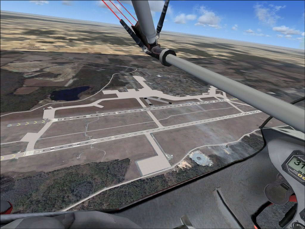
My first project is an Air Force Base I am quite familiar with. FSX's default rendition leaves me screaming in outrage. At this point, I'm doing fairly well as I've completed most of the aprons, all the taxiways, and the runways. All that's left is ground textures, parking, AI traffic, custom buildings/objects, and, and, and....the list goes on. However, I'm a perfectionist, so here goes:

Roads: My understanding is that the way to draw a road is using a vector line and not a taxi line, set to "vehicle". Is this correct? If so, I'm redoing an US Air Force Base. Would it be possible to have" airfield vehicles" also utilize roads. For example, Base Operations is responsible for checking the runways in the morning and periodically throughout the day. They begin by leaving their building which is attached to the tarmac, but they don't always return to their building this way. The sometimes leave on a road which connects to a normal road on base.

Photoreal textures: I'm hoping to include photo-real textures with this air base. The area I'm redoing not only includes the airport, but the surrounding area (the firing range used by A10s, the main base buildings, the highway we use to get to the base, etc.) Let me ask my question by describing my end goal and then hopefully someone can tell me the steps I need to take to accomplish that goal. My goal for the firing range (which FSX by default draws random subdivisions in) is to exclude the original autogen, lay down photoreal textures, and then generate the appropriate autogen on top of that (namely, vegetation). I will supply all buildings; I need there to be right kinds of vegetation in the right places without having to laydown 1000 object trees myself. Currently, I'm able to somewhat accomplish this by defining landclass polygons. However, the density of the vegetation is not right (nor does the ground texture itself) no matter what landclass I choose (and autogen setting is maxed out). Also, I'm not sure how I'd go about putting down a photoreal texture and still keep autogen vegetation.

Closed taxiways, true or false: Specifying "closed" for taxiways only affects the traffic and ATC-taxi instructions, not the visual appearance of the taxiway? I thought in one test run of my scenery that I saw the taxiway having an X drawn on it (like in real life), but ever since, I cannot seem to make it draw the X. I might have been halucinating as it was 4AM... If I was halucinating and FSX doesn't do this by default, then I know it's still possible to get text on taxiways. One thread I read recently discussed using Gmax to make a single polygon drawn horizontally, textured, exported/compiled, and then imported into your scenery design app (like ADE). I was just wondering if there might be a quicker way... (Call me a lazy perfectionist if you want...)

Slightly unrelated to ADE, but still relevant:
ALSF1 approach lights: The primary instrument runway at my base has ALSF1 approach lighting on both ends. As I'm an Air Traffic Controller, I know that the SFLs on that particular types of lights are not turned on unless required by weather or by request of the pilot. Flight Sim X seems to simulate this accurately. However, the secondary (and parallel) runway has MALSRs and the strobes on those flash no matter what. Unless I'm getting really rusty, those strobes aren't supposed to be turned on unless required by weather or pilot requested, just like ALSF1s... Am I wrong here? If not, is there a way to change when the lights show?

Runway lights: Ever since the dawn of FS, runway lights (with few exceptions) have been little round bulbs hovering over the ground with no base to support them and no glass to protect them. Would it be possible/feasible to gmax a very low poly-count runway light (5 or 6 sided at most) and place them in your scenery? I've read posts about issues with creating night lighting objects, but due to my newbness and the high-level discussion/verbage used, failed to understand what they were talking about.

Approaches: Air Force and possibly other branches have special approaches called HI-ILSs, and they are published on IAPs. Essentially, it is an ILS that starts very high (7,000 +). From my understanding as an air traffic controller, this is just a regular ILS but with a steeper descent path. I have yet to be able to speak with a pilot to confirm this from the pilot's point of view. I was wondering someone might be able to fill me in on these. Mostly what I want to know is if there is the glideslope signal actually transmitted at a steeper angle such that a steeper approach is needed to keep the glideslope needle on target? If so, can this be modelled in ADE/FSX? Similarly, military often arrive using a Simulated-Flameout (SFO) or similar approach. This begins overhead the airfield at altitudes around 7000 to 10000 (depending on the airframe executing the approach), and make a single spiraling descent to the runway in under 30 seconds. Is there a way to make AI traffic do this with a custom approach or would they not be able to handle such a rapid descent? I'm guessing that the answer to this question would also apply to the question of getting AI traffic to follow an overhead pattern vs the standard civillian rectangular.

Random animation scenery: I once purchased a scenery for a small grass airport that was quite fun. It had random sounds of a mechanic working on things, a guy that you could actually see mowing the lawn at certain times of the day on only certain days of the week, a barbeque going on Friday nights, etc. I can't remember the name or even what version of FS it was for, but it was history-making scenery back then and its methods proprietary. I was wondering if anyone was ever able to figure out how to go about doing the same thing? This base I'm trying to recreate has a lot of ground movement of towed aircraft, fuel trucks, police vehicles, mowers, etc. Default airports just seem so dead even with AI traffic...

That's enough for now. If you're still reading, thanks again....
 
highflight1985

I will answer some of your concerns but understand you have taken on a large project with advance ADE coding. Many Users not familiar with Airport Scenery Design should read our Docs and start out with a small project and build from there.

Roads: My understanding is that the way to draw a road is using a vector line and not a taxi line, set to "vehicle". Is this correct?

NO, draw the vector line and on a double click at the end you are presenetd with a window. Choose roads and in there is a list of many many type roads that become visual scenery for your airport. Vehicle traffic does not need roads but it looks much better if a road type is placed first and then Vehicle traffic overlayed onto the road.

Would it be possible to have" airfield vehicles" also utilize roads.

Yes that is possible and we do that with some of our airports. One problem is the vehicle traffic travels much faster then airport animated vehicles so they get runover at times.

Photoreal textures:

George is our beta guru on that subject

Closed taxiways, true or false:

Closed taxiways do not show the "X". Closed runways do. You MUST disconnect the taxiway from a node since ATC does not understand the term closed. Follow many FSX default airport examples of how a taxiway must be closed.

ALSF1 approach lights:

The approach lighting in FSX is weather sensitive if the airport is IMC. We have to live with what FSX does with the strobes when visibility is less then 3 miles. you can design your own approach lighting with other more powerful tools.

Approaches is a art form all its own in FS. Some of what you are asking can be done and some cannot. I will read over your request and answer after I review everything you have concerns with.

and welcome to our forum
 
Approaches: Air Force and possibly other branches have special approaches called HI-ILSs, and they are published on IAPs. Essentially, it is an ILS that starts very high (7,000 +). From my understanding as an air traffic controller, this is just a regular ILS but with a steeper descent path. I have yet to be able to speak with a pilot to confirm this from the pilot's point of view. I was wondering someone might be able to fill me in on these. Mostly what I want to know is if there is the glideslope signal actually transmitted at a steeper angle such that a steeper approach is needed to keep the glideslope needle on target? If so, can this be modelled in ADE/FSX?

Yes, Hi-ILS are honored in FSX and ADE will set the angle of the GS for the User Plane only. Click on either the Localizer long green triangle or the GS short green triangle and you will see the slope angle setting.

Some Math ----- the LOC is only good for 28NM from the symbol and GS is only good for 23 NM from its symbol. The standard that FSX uses is the 3 degree GS but they also have some 3.5's at some airports.

If you set the GS degree slope to 6 degrees then at 7000 ft the Plane intercepts the GS at 11.0 NM from the GS symbol (touch down target) which acts as a transmitter for the user plane only. Slot the plane for the proper Glide Path and you are falling like a rock.

AI Planes fall under a different set of rules so I will see what you are asking there and responsd a little later.
 
I am pondering some of your AI Approach issues but in the mean time I took a couple pictures where vehicle Freeway Traffic exits the roads and enters the Maint / Cargo area of this airport I am designing.

I cranked up the freeway traffic to 100 percent but for airports it should be no higher then 30 percent.

This first picture shows the Freeway Traffic overlayed on Roads |asphalt 2 lanes undivided in both directions (dark red vector shape line around the right side of the picture). Some of the Freeway traffic exits the road and travels onto what I call the pink line which is actually a vehicle path. Remember, freeway traffic does not know what a road is since it is a different type vector shape and will travel on anything.

Vehicle paths are like taxiway paths but for the animated parking spot to parking spot type airport traffic.


Looking down on top of the road you see the freeway traffic exit into the airport on a vehicle path.


In the next picture if this was a video you would eventually see the animated airport parking spot to parking spot vehicles show up traveling along with the freeway traffic (but at a slower speed). The airport animated gate to gate traffic will not turn toward the extrusion bridge but continue across the top of the "Y" intersection and go over to the Miltary Training side of this airport (right side of picture out of sight).


A footnote for others that may see these pictures. All of this is done with ADE. Some of it is very advanced design but shows some of the possibilities that ADE has.

Jon is looking at adding the extrusion type bridges into ADE since they are part of the FSdata and compile with the BGLComp compiler. One more note. Airport animated type traffic does not know what an extrusion bridge is. If I send animated airport traffic to the bridge it stays clamp to the ground and will not climb up a bridge like freeway traffic does.

George, don't make fun of my water fall :D

I still have not nailed down all those line triangles.
 
Jim,

Firstly, thank you so much for taking the time to read my lengthy post and for writing as lengthy of a response back! I really do appreciate that. Thank you for the kind welcome, and by the way, my name is Mike.

Secondly, nice airport! I like the waterfall... Only thing I would suggest is a different water texture unless this is in some airport in the Caribbean. Water ponds like this at airports are almost never that clean/blue. But, that's a FS-wide texture, so, unless you made the polygon in GMax and imported it, changing the texture would change all your textures in FS, right?

As for the special approaches: If I understand you, you're staying that HI-ILSs are possible in FSX. And yes, you would be falling like a rock--you should watch them practice on a sunny day. It's amazing! Even better is to watch a A10 drop out of the sky doing an SFO (called a TRP to A10 drivers) from 7000 to runway in a single spiral! Their landings are always graceful too; no wiggling/dancing or floating down the runway. Perfect, every time.

Essentially, what I was wanting to know is can the AI traffic deal with such steep descents as are required by HI-ILSs, SFO/TRPs? Likewise, can the AI traffic follow an overhead pattern? If you don't know what an overhead pattern is or what it looks like, there's a great video (of an A10, no less) doing the overhead pattern over at YouTube. Instead of entering the downwind from a 45° angle, you enter the pattern on the extended centerline anywhere from 3-5 miles out. This is called "Initial." When the lead pilot crosses the numbers, he "breaks" off in a steep slightly-descending turn to enter the downwind leg. Each additional element of the flight breaks a few seconds after the previous. The pilot then begins a much more steeply descending turn final and completes this turn such that when rolls out, he's no more than 1/4 mile away from the runway. I'm wondering if this is possible in FSX? Maybe fake it using some sort of "hidden" approach.

I see what you mean about the traffic. I'll give that a shot in my design and I'll post some screenshots once I've got it right. I really don't need to worry about the volume of traffic you do. This is only a military base. The busiest road is the one just outside the base; it's a 4-lane (divided, 2-lanes each direction) state highway with a speed limit of 45 just outside the base. On base, speed limit is 25, unless you're following the road around the runways and then it's 35. At any given time there's only about a dozen or so cars travelling that 35-limited road. Congestion only occurs in the main part of the base where most of the base is employed, and only during rush hours.

Just thought of another thing: Bewteen the main road just outside of base and the base gate itself, there's a railroad track. Does ADE have the ability to define railroads?

As for photoreal textures, I guess I'll have to hope and pray George sees this thread.

Closed taxiways: Okay, I must have just been seeing things then. I've actually drawn these not using taxiways, but aprons and not put any taxipaths on them. I was attempted to get the X's drawn on them by putting orphaned taxiways overtop with the "closed" tag on. Got nothing. I'll just put the X's on by using the GMax polygon thing...hopefully that will work.

Thanks again for the information. Please, keep the tips coming!

Mike
 
Thanks for the link, George.

Just finished reading the entire thread to date. It all seems relatively straight forward. Correct me if I'm wrong:

Using that method, I'll get a single set of photorealistic textures (of whatever season the textures were taken in) in day-only form. For other seasons and night textures, I'll have to go in and manually edit with a photo editor to adjust the colors of vegetation or add lights, respectively. Save those textures using the correct suffix for each season and night (whatever those are, I do not know at this moment), then rerun the batch file that was created during the first run.

Also, correct me here if I'm wrong: In order to create graduated textures, you would need to create a fade from white (photoreal area) to black (FS-default texture) on the textures which outline your area of scenery using the photo editor of choice.

You haven't by chance checked out SBuilderX for this purpose (photorealistic scenery), have you?
 
Last edited:
You haven't by chance checked out SBuilderX for this purpose (photorealistic scenery), have you?
I'm afraid I haven't Mike, but I understand it is very similar. I'm not sure whether the intermediate files are preserved.

Apart from that, you have the methods for Maps2Bgl covered.

Note, you can use GE or VE depending on which gives the better resolution.
 
Having just dabbled a little bit in SBuilderX to see what it could do, I'm at a standstill. I can't even get it download the tiles for the scenery. It seems SBuilderX runs into issues with causing users to get banned by IP from the servers and there's nothing you can do except hope your IP changes. If it does, you then have to hope that you can get through a download without being cut off and banned again. Well, that what's it seems anyway...

So, I gave Maps2BGL a go. I'm floored!!! Below is a screenshot of my base thus far and the photoreal scenery. It lines up PERFECTLY! I'm going to be expanding the area a bit more (this amount only took 20 minutes to do all totaled once I got Map2BGL going; it'll be even faster now that I don't have to follow the tutorial).

I have only two concerns now: 1. Doing this type of scenery gets rid of autogen. How do I go about getting it back? 2. I know you can rename textures to get night versions and other seasons, but the way Maps2BGL works by seemingly storing all textures in the BGL file, I'm not sure how to go about doing other seasons and night textures.

PhotoRealTest.jpg


P.S. Please excuse the black squares - that's an attempt at manually writing text on the ground and it is still a work in progress. Also, the above is using GE and I wouldn't dare using anything but GE...the VE photos aren't very good compared to GE--atleast not for this area.
 
awesome tool - one question that I didn't see addressed in the thread was how to increase the zoom factor... both default to lvl 16. I know for certain that VE can do up to 19 for the area that I'm working on... :)
 
1. Doing this type of scenery gets rid of autogen. How do I go about getting it back?
I'm afraid it's back to more reading. To create autogen, you need to use Autogen Annotator from the FSX SDK or you could use ADE to place library objects.

2. I know you can rename textures to get night versions and other seasons, but the way Maps2BGL works by seemingly storing all textures in the BGL file, I'm not sure how to go about doing other seasons and night textures.

I have not attempted to create seasonal textures, but you would need to edit the original bmps to reflect the seasons, edit the .inf files and re-run the .bat file. Make backups in case you make a mistake.
 
Last edited:
I know you can't tell, but there's a forest directly under me that goes for about 4 miles due east, completed covered in trees. If you were a monkey, you could literally walk the entire distance using only the tree tops. I'm certainly not going to try to fill it all back in with objects... Will do some research on the annotator...

As for the other issue, you mention editing an INF. I've looked at the INF and the BAT files. No lightbulbs seem to be going off for me. If I edit the tiles...well, I'd be editing all my life, and I'd get spots where the lighting/color effects didn't match up. Looking at the BMP that is created by the second step of Map2BGL, I think I'd be better off editing that instead. Possible?

Also, once I did edit them, would the new outputted BGL files for night/other-seasons cause a conflict with the first BGL files? That is, do you think if we renamed 16_000000.bmp to 16_000000_WI.bmp (WI for Winter), that FSX wouldn't get confused?
 
Last edited:
I know you can't tell, but there's a forest directly under me that goes for about 4 miles due east, completed covered in trees. If you were a monkey, you could literally walk the entire distance using only the tree tops. I'm certainly not going to try to fill it all back in with objects... Will do some research on the annotator...
You can easily create forests with the vegetation polygon tool in Annotator.

Looking at the BMP that is created by the second step of Map2BGL, I think I'd be better off editing that instead. Possible?
That's what I said ;)

Also, once I did edit them, would the new outputted BGL files for night/other-seasons cause a conflict with the first BGL files? That is, do you think if we renamed 16_000000.bmp to 16_000000_WI.bmp (WI for Winter), that FSX wouldn't get confused?
No FSX will not be confused, it uses the flight date to select the bgl compiled with the appropriate months.
 
Last edited:
Well, I thought I'd give it a try. I opened up the top half of the 2 textures. Since I didn't want to spend hours on this test, I just quickly added some text that said "Winter". I then renamed it to the original file name, adding _WI.bmp to the end. I did the same for the second half. I then went in to the INF and BAT files, and added _WI to all references to the textures. Then I ran the BAT again. No errors. Copied the output files (same name as original, just _WI.bgl at the end) to the addon scenery folder....

Checked all seasons....didn't see the text on the ground. What am I doing wrong?

Have you done this (or even night textures) before? If so, can you give a step-by-step?

EDIT: Now I'm running into a problem with just downloading the tiles. I decided to expand the area coverage a little bit more than what was in the original. Now when the tiles are made into a single bmp, some are there, the rest is white?
 
Last edited:
Have you done this (or even night textures) before? If so, can you give a step-by-step?
In my very first reply I stated that I hadn't made seasonal textures. However, it should be very straightforward.

Now when the tiles are made into a single bmp, some are there, the rest is white?
That's GE for you :D

Edit. You will need to modify the .inf file to include "Variaton" months.
 
Last edited:
Yes, it works fine. Here are two variations, January to June (J-J) and July to December (J-D)


Note. You need to change the names of the bgl files so that they are not overwritten on the next resample run.
 
Last edited:
As for the special approaches: If I understand you, you're staying that HI-ILSs are possible in FSX.

Yes, but for the User Plane ONLY. The ILS that you see on the Grid of ADE is owned by the Runway. What that means is the Transmitters for the LOC and GS are the actual symbols but read by FSX as a Lat/Lon in XML format.

What that is used for is the Plane you are flying ONLY. The XML is so the radio will read a LOC and GS and display on the CDI. The ILS is owned by the runway for other reasons also such as pattern flying.

Since the ILS is owned by the runway that code has nothing to do with ATC or the AI Engine. For ATC to understand a ILS exist for a runway we write a ILS approach code that is in a different part of the total XML that compiles to a airport.bgl.

We can write a High ILS for the AI Plane but the AI Engine was not designed for combat type landings. There are code in the .dll files that work in unison with the XML approach code. If I set a hardfloor FAF of 7000 ft what I am trying to do is force the AI Engine to hold the planes altitude much closer to the runway threshold. Since the .dll file processing is downstream from the XML we write the AI Engine will vector the plane at that high altitude further out on a longer extended final.

The AI Engine is working with the VS decsent ft/min. If the written XML says the VS ft/min would calculate to 3000 ft/min the .dll steps in and recaulates it more for the GA / large Planes with a desired value of max 1500 ft/min. With all that said that rules out a Hi ILS for AI planes.

The AI Engine/ATC is designed for a 30 degree intercept heading to final angle pretty much like real world. We do have a way to change final approach runway angle but only up to a certain heading such as a LDA, SDA, IGS type approach. We can curve the approach up to about 80 degrees from runway center line. We can also make a circle to land approach but have to approach the airport on a 90 degree angle from a IF or IAF. This 90 degree angle must start out at the IAF/IF and course toward the center of a runway. When reaching center of the runway at the FAF altitude of 2000 ft AGL the plane will circle and land based on wind direction. That rules out a military overhead pattern.

Like I said the AI Engine is more for GA / Airline type planes and not what military will normally do. There are web sits that deal with Military /AI and some have got the planes to fly formation but approaches is a different animal altogether.
 
Jim,

Thanks for the detailed explaination. I guess I can only ask for so much from a single flight simulator that's trying to cover all aspects of aviation. Would be nice though: In all the years of Flight Simulators and the sheer volume of military-minded simmers, it's hard to believe that the overhead pattern is something that FS left out. I can understand high ILS for AI traffic (we just got AI traffic not too long ago) and ATC (again--not too long ago). And I can understand the lack of SFO type approaches.

George,

You mentioned modifying the .inf. Currently, due to GE being cranky and not letting me download tiles still, I don't have an .inf to look at to see what you mean about the variation. (I didn't previously see that in the .inf). Could you post a copy of one of yours used in the above screenshots?

highflight1985 said:
...do you think if we renamed 16_000000.bmp to 16_000000_WI.bmp (WI for Winter), that FSX wouldn't get confused?

Golf-HotelDelta said:
Note. You need to change the names of the bgl files so that they are not overwritten on the next resample run.

I ran the first set of photoreal bgls. Removed them from the output directory and moved them into FSX to see if they worked. (They did as you can see by the screenshots before...) I then ran the output again, but before I did, I changed all the file names and all the references within the .inf to include _WI at the end. That might have been overkill; I think the key is the variation thing you mentioned.


Now if I could just get GE to behave!
 
Last edited:
Could you post a copy of one of yours used in the above screenshots?

Code:
[Source]

Type = MultiSource
NumberOfSources = 2

[Source1]

Type = BMP
SourceDir = "."
SourceFile = "16_000000.bmp"
Layer = Imagery
[B][COLOR="Red"]Variation = January,February,March,April,May,June[/COLOR][/B]
NullValue = 255,255,255
ulxMap =  103.88671875
ulyMap =  1.40610883543525
Nrows = 4096
Ncols = 4096
Xdim =  2.14576721191406E-05
Ydim =  2.14516060969594E-05
PixelIsPoint = 0
SamplingMethod = gaussian
Channel_BlendMask = 2.0

[Source2]

Type = TIFF
Layer = None
SourceDir = "."
SourceFile = 16_000000.tif
ULXMAP = 103.88671875
ULYMap = 1.40610883543525
xdim = 5.23868948221207E-09
ydim = 5.23720851976549E-09
Nrows = 4096
Ncols = 4096
SamplingMethod = Gaussian

[Destination]

DestDir = "G:\Maps2Bgl\Maps2Bgl_X\bglcache"
DestBaseFileName = "16_51680_32512"
DestFileType = BGL
CompressionQuality = 80
LOD = 5,15

Note. The filenames are immaterial, it is conventional to have _SU etc. but it is not necessary since FSX loads the correct file according to the "Variation".
 
Back
Top