• Which the release of FS2020 we see an explosition of activity on the forun and of course we are very happy to see this. But having all questions about FS2020 in one forum becomes a bit messy. So therefore we would like to ask you all to use the following guidelines when posting your questions:

    • Tag FS2020 specific questions with the MSFS2020 tag.
    • Questions about making 3D assets can be posted in the 3D asset design forum. Either post them in the subforum of the modelling tool you use or in the general forum if they are general.
    • Questions about aircraft design can be posted in the Aircraft design forum
    • Questions about airport design can be posted in the FS2020 airport design forum. Once airport development tools have been updated for FS2020 you can post tool speciifc questions in the subforums of those tools as well of course.
    • Questions about terrain design can be posted in the FS2020 terrain design forum.
    • Questions about SimConnect can be posted in the SimConnect forum.

    Any other question that is not specific to an aspect of development or tool can be posted in the General chat forum.

    By following these guidelines we make sure that the forums remain easy to read for everybody and also that the right people can find your post to answer it.

Editing Season Regions (Specfically Florida, USA)

Messages
4
Country
unitedstates
Greetings,

Hopefully this is the right area of the forum to ask this question.

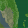
Currently in FSX, the seasonal changes are horrendous for Florida. Florida looks pretty much the same year round. They don't have Fall like the majority of the states have. Even when looking at the seasons.bgl in tmpfviewer (sp) there is a cut out of South Western FL where it has a fall atmosphere. :banghead: And looking at the rest of the Caribbean, they seem to have the same problem.

Is there a method where I can change the regional season settings where it is just the summer layout year round? If so, how can I do this?

Thanks.
 

arno

Administrator
Staff member
FSDevConf team
Resource contributor
Messages
32,885
Country
netherlands
Did you check the sdk? It contains information on changing the seasons. Basically you need to make a new seasons bgl with resample.
 
Messages
4
Country
unitedstates
Did you check the sdk? It contains information on changing the seasons. Basically you need to make a new seasons bgl with resample.

Thanks for the reply.

Am I extracting the information from seasons bgl then recompiling it? I think that is where I am getting lost.
 

arno

Administrator
Staff member
FSDevConf team
Resource contributor
Messages
32,885
Country
netherlands
Typically you would make a new season raster as input, instead of decompile the existing one.
 
Messages
4
Country
unitedstates
Ok.

I found some information in the SDK about seasons. But I am not sure on how the format flows to put into the INF file to resample it into the BGL. Any suggestions where to look?

Funny enough, doing some bit of digging I found this;

http://www.fsdeveloper.com/forum/threads/seasons-bgl-which-forum.3503/

Seems that poster (Scott) had a TIFF file to use to sample into the .bgl file.

Gonna do some more digging in what he did...
 
Last edited:
Messages
4
Country
unitedstates
Ok, so I made the change to the season for a place in South West Florida.

The above link had a poster try EZ-Landclass, and it worked for him (and me).

Now, the question I have is in the INF file, I have the following;

[Source]
Type=Raw
Layer=Season
SourceDir="C:\FSX SDK\Florida Project"
SourceFile="Florida.raw"
Month = 9,10,11,12
ulyMap= 28.125
ulxMap=-82.5
ncols=257
nrows=257
xdim= .0146484375
ydim= .010986328125
bandlayout=bsq
byteorder=intel
nbands=1
sampletype=uint8
NullValue=254
SamplingMethod=Point

[Destination]
UseSourceDimensions=1
DestDir="C:\FSX SDK\Florida Project\FSX"
DestBaseFileName="Florida"

Is there a simple method using this to change a wide area? Looking in the EZ Class project, trying to figure out the Long / Lat coordinates, they don't match up with what TmfViewer is saying the coordinates are.

Any idea?
 
Messages
284
Country
us-newyork
This is how the original (full) seasons.bgl is built:
Code:
; QMID 15 season data

[Source]
Type = MultiSource
NumberOfSources = 12

[Source1]
Type = RAW
Layer = Season
SourceDir = .
SourceFile = "SEASON-7-0-0-JAN.raw"
Month=1
GCS = WGS84
nCols = 24577
nRows = 16385
ULXMAP = -180.0000
ULYMAP = 90.0000
PixelIsPoint = 1
XDIM = 0.0146484375
YDIM = 0.010986328125
BandLayout = BIP
SampleType = UINT8
nBands = 1

[Source2]
...
...

[Destination]
DestDir = .
DestBaseFileName = "seasons"
UseSourceDimensions = 1
LOD=13
CompressionQuality = 100

I'm not sure I understand your question, but the same logic can be used to build a BGL of any area to replace. The only thing you should need to change is the UL(X|Y)MAP to the LATLON of the center of the top left pixel of your area, with the correct nCols and nRows to match your source.

Your source is just a raw file with 257x257 bytes, values 0-4, you could generate these through code or a hex editor, or even use my BGLDEC tool to modify the existing data by extracting the areas out you don't need. I could add the option to clip the output to a specific LATLON range so you don't have to manipulate the output through code yourself.

I'm unfamiliar with EZ Landclass, but LATLON stated above correlate with what you see in TMFViewer. So with those dimensions you are replacing season data for the entire square:
 

Attachments

  • qmid.PNG
    qmid.PNG
    313.9 KB · Views: 294
Messages
1
Country
colombia
Hi reading this thread some could create a seasons.bgl file to correct Florida issue?

I don't want to make a big correction, just correct Florida issue and move the beginning of autumn to 1st of October instead of 1st of September.
 
Top