• Which the release of FS2020 we see an explosition of activity on the forun and of course we are very happy to see this. But having all questions about FS2020 in one forum becomes a bit messy. So therefore we would like to ask you all to use the following guidelines when posting your questions:

    • Tag FS2020 specific questions with the MSFS2020 tag.
    • Questions about making 3D assets can be posted in the 3D asset design forum. Either post them in the subforum of the modelling tool you use or in the general forum if they are general.
    • Questions about aircraft design can be posted in the Aircraft design forum
    • Questions about airport design can be posted in the FS2020 airport design forum. Once airport development tools have been updated for FS2020 you can post tool speciifc questions in the subforums of those tools as well of course.
    • Questions about terrain design can be posted in the FS2020 terrain design forum.
    • Questions about SimConnect can be posted in the SimConnect forum.

    Any other question that is not specific to an aspect of development or tool can be posted in the General chat forum.

    By following these guidelines we make sure that the forums remain easy to read for everybody and also that the right people can find your post to answer it.

FSX Elevated runway, mesh problem

Messages
118
Hello.
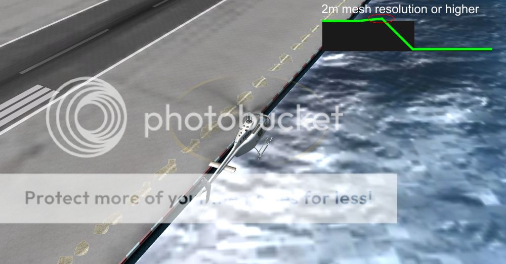
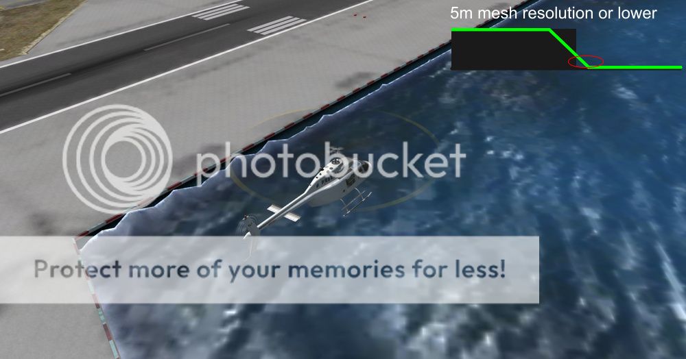
I am not very good in mesh design hence I was trying to fix this issues in many ways, including Sbuilder flattens, FSX KML double flattens (top and botton), AFCAD flattens, some SCASM flattens... There is however still a problem. I don't understand why my terrain goes actually higher than the top flatten, which causes ground to be visible on the first screenshot, through the concrete. I would appreciate any suggestion, link or whatever you can share... I guess I am doing something stupid, just can't figure our what...
mesh1_zps8ab94ea9.jpg


mesh2_zps805fcf3e.jpg
 
Hi Stanislaw,

unfortunately that's a problem with the way FSX interpolates between adjacent elevation points, it's like a damped sine wave. Similarly, if you have a flattened lake next to a steep cliff you can often see the shoreline elevations dipping below the level of the water flatten.

You could experiment with splitting your flatten into smaller segments or adding a sloped flatten between the top and bottom poly, making sure that adjacent polys precisely align along edges without gaps or overlaps. Another approach is to force the flatten priority of your lower (=waterbody) poly to be higher though that might require custom entries to terrain.cfg.

In cases like yours it's probably better to not rely on terrain flattens and use a hardened platform in the model instead.

Cheers, Holger
 
Hello Holger.
Thank you very much for your suggestions.

I am using a hardened platform indeed, but I am also using an invisible SCASM runway for runway lights. And it does flatten the surrounding surface resulting in an effect from the 1st screenshot... That was the only reason why I have inserted an additional top flatten.
 
Thank you Holger, thanks to your suggestion I was able to achieve a result I needed.

lga2_zps2f358bec.jpg

lga1_zps79e1989c.jpg


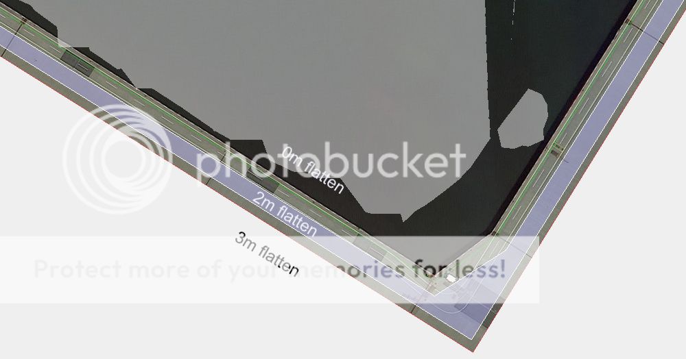
I've simply used 3 flattens - at 0m, 2m and 3m. It works just perfect at the 2m resolution.

lga3_zpsaad1c3ef.jpg
 
Back
Top