Hi Gary,
Below is a Sketchup project I've been working on for weeks now, and it's the Baptist Montclair Hospital which is 3 mile south of runway 36/18:

There are about 6 or 7 buildings that occupy the project and sits on a hill 3 miles south of the airport. It being on a hill, and where the terrain is so uneven, and is not flat at all, has made it really hard to get everything to line-up and be at the correct height. Notice that the parking deck is lower than the main hospital and how the left side terrain rises as you go up-hill. I had to take all of this elevation into consideration and since the ground elevation changes so often, I could not measure from the ground up. I had to pick an object, such as the top of the highest building and measure from that point down, using that as a reference. Many times, the top of one building would not line up properly with the building next to it, and had to start over. It's not perfect but it's as close as I can get it, based on the information I got from google earth pro.
I was wondering if there's a technique, or a plugin that I can install in sketchup that will make the terrain change as it does in the real world, maybe using elevation data. The way I'm having to do it is to draw square faces that rise with the ground, and it's sort of like drawing or having block faces, if you understand what I mean. If the ground rises or decends in 2 or more directs at the same time, it's not possible to get a face out of it because everything's is out of plain. You'll noticed that the terrain surrounding the parking deck is not quite connected to the terrain above it, and that's because I've haven't finished that part of it.
Below is a Sketchup view of the parking deck where cars enter the ramp:

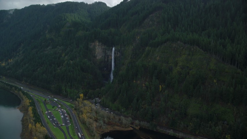
I've left these white so that you can see how I've been drawing the changes to the terrain. Cars enter the ramp either from the left entrance or the entrance on the right, which is about 9 feet higher the one on the left. In the real world, changes to the rise of the terrain dose not rise as I have it drawn but this is the only way I know how. Look at the photo below and see the real world of how the terrain changes:

If there's a plugin, or a technique, could you give me some advice? I am using Sketchup version 8.0.16846
Ken.
Below is a Sketchup project I've been working on for weeks now, and it's the Baptist Montclair Hospital which is 3 mile south of runway 36/18:
There are about 6 or 7 buildings that occupy the project and sits on a hill 3 miles south of the airport. It being on a hill, and where the terrain is so uneven, and is not flat at all, has made it really hard to get everything to line-up and be at the correct height. Notice that the parking deck is lower than the main hospital and how the left side terrain rises as you go up-hill. I had to take all of this elevation into consideration and since the ground elevation changes so often, I could not measure from the ground up. I had to pick an object, such as the top of the highest building and measure from that point down, using that as a reference. Many times, the top of one building would not line up properly with the building next to it, and had to start over. It's not perfect but it's as close as I can get it, based on the information I got from google earth pro.
I was wondering if there's a technique, or a plugin that I can install in sketchup that will make the terrain change as it does in the real world, maybe using elevation data. The way I'm having to do it is to draw square faces that rise with the ground, and it's sort of like drawing or having block faces, if you understand what I mean. If the ground rises or decends in 2 or more directs at the same time, it's not possible to get a face out of it because everything's is out of plain. You'll noticed that the terrain surrounding the parking deck is not quite connected to the terrain above it, and that's because I've haven't finished that part of it.
Below is a Sketchup view of the parking deck where cars enter the ramp:
I've left these white so that you can see how I've been drawing the changes to the terrain. Cars enter the ramp either from the left entrance or the entrance on the right, which is about 9 feet higher the one on the left. In the real world, changes to the rise of the terrain dose not rise as I have it drawn but this is the only way I know how. Look at the photo below and see the real world of how the terrain changes:
If there's a plugin, or a technique, could you give me some advice? I am using Sketchup version 8.0.16846
Ken.
Last edited:


")


")

