• Which the release of FS2020 we see an explosition of activity on the forun and of course we are very happy to see this. But having all questions about FS2020 in one forum becomes a bit messy. So therefore we would like to ask you all to use the following guidelines when posting your questions:

    • Tag FS2020 specific questions with the MSFS2020 tag.
    • Questions about making 3D assets can be posted in the 3D asset design forum. Either post them in the subforum of the modelling tool you use or in the general forum if they are general.
    • Questions about aircraft design can be posted in the Aircraft design forum
    • Questions about airport design can be posted in the FS2020 airport design forum. Once airport development tools have been updated for FS2020 you can post tool speciifc questions in the subforums of those tools as well of course.
    • Questions about terrain design can be posted in the FS2020 terrain design forum.
    • Questions about SimConnect can be posted in the SimConnect forum.

    Any other question that is not specific to an aspect of development or tool can be posted in the General chat forum.

    By following these guidelines we make sure that the forums remain easy to read for everybody and also that the right people can find your post to answer it.

P3D v4 Cant get water to show at airport?

I'm also wondering why water wont show when there is no photo-real bgl placed to block it.

The Read_Me for your FSX 69B add-on suggests you also use OrbX non-terrain scenery, which may impact the 69B Area Of Interest (aka "AOI").

Please list which Payware and Freeware packages from Orbx you have installed in P3Dv4.

We may have to inspect what any such OrbX add-ons do to the AOI, even if PR Masking proves to NOT be the culprit..


It is not uncommon for very large Terrain Exclusion Polygons to be used by OrbX for some / all CVX LC terrain objects in some areas.

GaryGB
 
Here is what I have from Orbx.
 

Attachments

  • Orbx.jpg
    Orbx.jpg
    115.4 KB · Views: 24
YIKES !!! :yikes:

That list may qualify for a multi-"Orb", 'Full Monty' award.:rotfl:


https://en.wikipedia.org/wiki/Sleeper_(1973_film)


I'll need to confirm extent of coverage for Southern California.

Then I 'll need to confirm any impact it, Global, and OpenLC North America may have on 69B when loaded / rendered alongside your own add-on.


Did OrbX ever implement a "quick disable all" feature for its add-ons via FTX Central ?


FYI: I stopped buying their products many years ago before they moved everything to OrbX Direct and changed most product infrastructure.

I shall attempt to still complete the intended task if possible via my own years of FS2Kx insight; but with that load scenario, the "Onus Is On OrbX".

If I am not able to do what I intended within reasonable efforts, it may still prove necessary for you to seek support via the OrbX support forums.


I'll post results incrementally as they are completed; I should be able to get more done with this tomorrow (Thursday). :scratchch

GaryGB
 
Last edited:
I got them all on sales, I'm not a full price kinda guy or I'd go broke! Haha.

I don't believe they implemented a quick on and off. I'll have to manually adjust. I'll work on that tonight and see if the water shows through. Will report back.
 
We need to initially confirm extent of Orbx' coverage for Southern California.

I do not recall if the Southern California PDF manual came with an illustration of the coverage area; do you see any such declaration of extent ?


Then we need to confirm any impact it, Global, and OpenLC North America may have on 69B when loaded / rendered alongside your own add-on.


GaryGB
 
Photoreal bgl disabled, NA Southern CA disabled, OpenLC NA disabled, and still no water shows through.
 

Attachments

  • 2025-10-1_22-38-15-801.png
    2025-10-1_22-38-15-801.png
    4.4 MB · Views: 26
OK, thanks for the updated status.

Tomorrow I plan to test further with a P3Dv4 SDK compiled custom PR LC texture draped onto a higher resolution terrain mesh.

I'll also create a local TIN flatten that is 'level' (non-sloped) for each water tank base at local Altitude of the terrain mesh to test the PR texture drape.


A Global Mapper 3D preview of the higher resolution DEM with a lower resolution ESRI World Imagery texture drape: ;)

69B_Global_Mapper_3D_Preview_USGS_3DEP_DEM-1.jpg


A SASPlanet preview of BING / MSVE aerial imagery at Zoom Level-21:

69B_SASPlanet_USGS_3DEP_DEM_BING_Satellite-1.png


More to come tomorrow (Thursday). :)

GaryGB
 
Last edited:
Wow that sat image is a lot better quality! Also an updated image as they no longer have the pumpkins, but have switched to the larger metal tanks to accommodate the chinooks. I tried added flattening CVX with no addon scenery and still no water shows. Even tried adding a dry woody scrub landclass below the water but above the flatten CVX, with no change. Truly perplexing.
 

Attachments

  • ADE.jpg
    ADE.jpg
    852.8 KB · Views: 24
I plan to get started with my testing later today; I'll see what happens initially with a basic Hydro Polygon LC and a custom PR LC. :)


I am doubtful MSVE / BING would complain if you used their imagery for an add-on that was publicly distributed, especially if it was only a small area.

You can access that imagery with SASPlanet; I use the numeric version shown in the screenshot, but there may be newer versions that also work OK.

SASPlanet is "Eastern Block" software, accesses tileservers less commonly known in the West, but can still output high resolution "Western" imagery.


GaryGB
 
Last edited:
My anticipated 69B testing schedule has been delayed by yet another day; I hope to be compiling some BGLs ASAP; perhaps later Friday.

GaryGB
 
Ok, initial test of a CVX Vector LC Polygon: Hydro_Default_Perennial above a layer containing a local CVX Vector Exclude: Exclude_All_Terrain_Items:

(This is P3Dv4.5 default LC textures (no PR aerial imagery), and (probably) FreeMeshX 30 Meter terrain)

P3Dv4_69B_CH+_Hydro_Default_Perennial_Exclude_All_Terrain_Items_SLOPED-1.jpg


At best, we see a 'hint' of a semi-translucent Hydro Polygon that attempts to slope (it is supposed to be capable of terrain mesh-clinging).

Next I plan to test the same CVX Vector LC Polygon: Hydro_Default_Perennial above a local CVX Vector Exclude: Exclude_All_Terrain_Items.

But this time I will also place an AB Flatten at local ground surface Altitude underneath the CVX Vector LC Polygon: Hydro_Default_Perennial.


UPDATE: No difference seen adding a AB Flatten at local ground surface Altitude underneath the CVX Vector LC Polygon: Hydro_Default_Perennial

In fact, the ground will not flatten where it was instructed to do so.

Hmmm... is this more of the infamous, insidious evil AFD infrastructure of the nearest ARP usurping the assigned Altitude of my local 69B ABP ? :stirthepo


Later, I plan to test SDK Resample PR aerial imagery with a "Hole", Water and Blend Masks, and underlying Water Class color will display in P3Dv4.x.

GaryGB
 
Last edited:
Considering the curious behavior of this scenery and location, I have been reviewing threads on related topics.

I still do not see a Hydro attribute after compiling your source files:

* Without a NullValue parameter in the INF

* After both Mask files are converted to 8-Bit Grayscale TIFF, but with no other change to the 24-Bit original TIFFs.


Looks like I'll need to go for "The Full Monty" on this one. :scratchch


BTW: The 24-Bit *_LM.TIF you attached above 'will' work, but only after editing the file extension from BMP to TIF in the INF file. ;)


More tests to come, as time permits this weekend.

GaryGB
 
Very strange why this is being such a pain. I was following a youtube video for how to create photoreal scenery with water showing through it. He made it seem so easy! Maybe I just need to stick to repainting and give up on scenery haha.
 
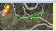
Before considering giving up, I believe it would be best to open the TIF Blend and Water masks in GIMP and export them precisely as cited here:

https://www.fsdeveloper.com/forum/threads/cant-get-water-to-show-at-airport.460289/post-936014


https://www.fsdeveloper.com/forum/threads/resample-tool-not-working.448011/post-847770

"For SDK Resample compatibility in source images output by PhotoShop and GIMP, ensure 'output' options meet the following criteria: :pushpin:


When Day / Seasonal variation "visible" source images are 'Saved' as a 24-Bit color *.BMP, configure the file format with:

* "Run Length Encoded" (aka "RLE") NOT checked

* "Do NOT write color space information" checked

* "24-Bits" (R8 G8 B8) 'ticked'


When Blend and Water Mask 'data' source images are 'Saved' as a 8-Bit gray-scale '(256)-color-step' *.TIF, configure the file format with:

* NO compression, whether FAX - CCITT 3, Huffman Encoding, LZW, PackBits etc.

* RGB NOT CMYK

* NO ICC sRGB Color Space Profile Embedded

* Optimized NOT Custom Palette"


I researched this fairly extensively a few years ago, and of what little I recall, there 'were' settings in GIMP dialogs to control all output parameters.


I do not use GIMP or PhotoShop (I use Corel PhotoPaint, which reads file info, but may not have certain output parameters controls to 'fix' this).

So, for best tests of TIFF file format compatibility, the onus is on you to ensure optimal SDK compliance (although FS2Kx SDK docs failed us here).


IMHO it is possible vague conclusions in forums about FS2Kx SDK Resample "tolerating" / "ignoring" TIFF status / alert messages ...are not correct.

IIRC, there are scenarios where TIFF status / alert messages are associated with custom PR LC malfunctions even though Resample still writes BGLs.


So, although I am prepared to test further, it may save me time and effort to know results of your tests with Masks made precisely to SDK specs. ;)

GaryGB
 
Last edited:
A Global Mapper 3D preview of the higher resolution DEM draped with higher resolution SASPlanet BING / MSVE aerial imagery at Zoom Level-21:

69B_GM_3D_Preview_USGS_3DEP_DEM_SASPlanet_BING_Satellite-1.png


GaryGB
 
Work got busy, but it was good to step back and take a breath. I'll try using GIMP later today with the specs you posted above and see if that helps.
 
Maybe getting somewhere? Messed with it over the weekend and wasnt able to make progress with GIMP. Sooo did some more searching and I had to upgrade to GIMP 3, from my old 2. After resaving the TIF and BMP files and recompiling the BGL, I am seeing NO warnings like I was previously. I have yet to reinstall and test in the sim.
 

Attachments

  • SBX.jpg
    SBX.jpg
    356.1 KB · Views: 23
Back
Top