
Congratulations, Peter. ")
By having used GeoTIFF2INF you now have the Geo-referencing info inside the INF file'; it is best to always keep it in that file.
One must edit the source file(s) for imagery to implement any desired changes; we can not edit SDK Resample compiled BGLs.
If you are careful to keep all source image(s) at exactly the same total number of pixel rows and columns during editing, the Geo-referencing info inside the INF file will allow you to work with impunity on the GeoTiff, because the the Geo-referencing info inside the GeoTiff file header is lost with all but a (very) few graphics applications (ex: Paint.NET does not lose GeoTiff Geo-referencing).
If you opt to use GIMP, be aware of some quirks to avoid incompatibility of any file format changes it would impose on output:
https://www.fsdeveloper.com/forum/threads/resample-exe-not-working.445075/post-819410
https://www.fsdeveloper.com/forum/threads/resample-cannot-open-bmp-file.450316/
Now you must contemplate what you wish to achieve with your imagery BGL.
Most FSDevs want to apply basic corrections to sharpness, contrast, brightness, gamma, and FS color palette compatibility.
Next, they want Night textures, and seasonal variants that automatically switch with time of day / year.
Others want imagery textured Ground Polygons (aka "G-Polys) as flat / level 3D objects with FS attributes 'terrain' can not show.
FSDeveloper is the place to "read all about it". and learning can take quite some time depending on what one wishes to do.
Note that this is the core query structure I would use on Google to perform more comprehensive searches at FSDev forums:
https://www.google.com/search?q=site:www.fsdeveloper.com+custom+photoreal+land+class+imagery&client=firefox-b-1-d&ei=AIyKY4_gE73cptQP2PmesA4&ved=0ahUKEwiP4P_1jNz7AhU9rokEHdi8B-YQ4dUDCBA&oq=site:www.fsdeveloper.com+custom+photoreal+land+class+imagery&gs_lcp=Cgxnd3Mtd2l6LXNlcnAQDEoECEEYAUoECEYYAFClGFjbuAFg7NoBaARwAHgAgAFJiAH5D5IBAjM2mAEAoAEBwAEB&sclient=gws-wiz-serp
I suggest trying SBuilderX' methods, so that you have a built in engine to combine variant imagery files / channels in (1) INF file.
Here is an excerpt from one of my prior posts pertinent to what, IIUC, you may be wanting to achieve:
To learn procedures for making more accurate scenery in local FS world areas, you may wish to review this tutorial:

Terrain Design
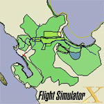
File Description:
Terrain Design for Flight Simulator X
This simple illustrated document explains the basic concepts in Flight Simulator X terrain, and how to change them using SBuilder for FS X. Make new water bodies, roads, vehicle traffic, airport flattens, remove autogen, add more detail - anybody can do it easily and quickly.
My most sincere apologies - I am unable, for lack of free time, to offer support of any kind. For questions or problems, please post in the Avsim scenery design forum.
Filename: terrain_design_for_flight_simulator_x.zip
License: Freeware
Added: 14th December 2009, 13:29:15
Downloads: 16648
Author: Luis Feliz-Tirado
Size: 3991kb
https://library.avsim.net/esearch.php?CatID=fsxsd&DLID=141643
To make more accurate FS scenery, you are likely to also encounter these topics at some point as well:
Make photo-real ground textures
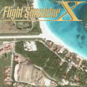
File Description:
It is very easy to create your very own high-resolution, custom (photo-real) ground textures. This document explains the concepts and techniques and illustrates the use of SBuilderX with which you can quickly and easily download aerial images and make this type of scenery. So, why hesitate? Make Flight Simulator scenery as real as it gets! Very sorry - no support of any kind is offered. Please do not write. For any questions, please post in the Avsim Scenery Design Forum.
Filename: make_photo-real_ground_textures_in_fs_x.zip
License: Freeware
Added: 21st November 2009, 23:20:06
Downloads: 17714
Author: Luis Feliz-Tirado
Size: 2143kb
How to create photoreal scenery for FSX
https://library.avsim.net/esearch.php?CatID=fsxsd&DLID=140539
Using the Autogen Annotator
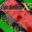
File Description:
The Autogen Annotator is a powerful tool for modifying the autogen of default ground textures or adding autogen to custom (photo-real) ground. This document illustrates the use of the tool, and includes a pictorial guide to all autogen object types. Very sorry - no support of any kind is offered. Please do not write. For any questions, please post in the Avsim Scenery Design Forum.
Filename: using_the_autogen_annotator_264833.zip
License: Freeware
Added: 21st November 2009, 16:18:51
Downloads: 4220
Author: Luis Feliz-Tirado
Size: 8930kb
https://library.avsim.net/esearch.php?CatID=fsxsd&DLID=140537
You may also wish to review at least the first few pages of this (long) very informative thread by Tiberius et al:
https://www.flightsim.com/vbfs/showthread.php?250762-How-to-create-photoreal-scenery-for-FSX:
PS: That thread has numerous contributions by Jim Robinson, which expand our knowledge of how to better use SBuilderX.
I hope this helps with the learning process on this topic.
GaryGB
By having used GeoTIFF2INF you now have the Geo-referencing info inside the INF file'; it is best to always keep it in that file.
One must edit the source file(s) for imagery to implement any desired changes; we can not edit SDK Resample compiled BGLs.
If you are careful to keep all source image(s) at exactly the same total number of pixel rows and columns during editing, the Geo-referencing info inside the INF file will allow you to work with impunity on the GeoTiff, because the the Geo-referencing info inside the GeoTiff file header is lost with all but a (very) few graphics applications (ex: Paint.NET does not lose GeoTiff Geo-referencing).
If you opt to use GIMP, be aware of some quirks to avoid incompatibility of any file format changes it would impose on output:
https://www.fsdeveloper.com/forum/threads/resample-exe-not-working.445075/post-819410
https://www.fsdeveloper.com/forum/threads/resample-cannot-open-bmp-file.450316/
Now you must contemplate what you wish to achieve with your imagery BGL.
Most FSDevs want to apply basic corrections to sharpness, contrast, brightness, gamma, and FS color palette compatibility.
Next, they want Night textures, and seasonal variants that automatically switch with time of day / year.
Others want imagery textured Ground Polygons (aka "G-Polys) as flat / level 3D objects with FS attributes 'terrain' can not show.
FSDeveloper is the place to "read all about it". and learning can take quite some time depending on what one wishes to do.
Note that this is the core query structure I would use on Google to perform more comprehensive searches at FSDev forums:
https://www.google.com/search?q=site:www.fsdeveloper.com+custom+photoreal+land+class+imagery&client=firefox-b-1-d&ei=AIyKY4_gE73cptQP2PmesA4&ved=0ahUKEwiP4P_1jNz7AhU9rokEHdi8B-YQ4dUDCBA&oq=site:www.fsdeveloper.com+custom+photoreal+land+class+imagery&gs_lcp=Cgxnd3Mtd2l6LXNlcnAQDEoECEEYAUoECEYYAFClGFjbuAFg7NoBaARwAHgAgAFJiAH5D5IBAjM2mAEAoAEBwAEB&sclient=gws-wiz-serp
I suggest trying SBuilderX' methods, so that you have a built in engine to combine variant imagery files / channels in (1) INF file.
Here is an excerpt from one of my prior posts pertinent to what, IIUC, you may be wanting to achieve:
To learn procedures for making more accurate scenery in local FS world areas, you may wish to review this tutorial:
Terrain Design
File Description:
Terrain Design for Flight Simulator X
This simple illustrated document explains the basic concepts in Flight Simulator X terrain, and how to change them using SBuilder for FS X. Make new water bodies, roads, vehicle traffic, airport flattens, remove autogen, add more detail - anybody can do it easily and quickly.
My most sincere apologies - I am unable, for lack of free time, to offer support of any kind. For questions or problems, please post in the Avsim scenery design forum.
Filename: terrain_design_for_flight_simulator_x.zip
License: Freeware
Added: 14th December 2009, 13:29:15
Downloads: 16648
Author: Luis Feliz-Tirado
Size: 3991kb
https://library.avsim.net/esearch.php?CatID=fsxsd&DLID=141643
To make more accurate FS scenery, you are likely to also encounter these topics at some point as well:
Make photo-real ground textures
File Description:
It is very easy to create your very own high-resolution, custom (photo-real) ground textures. This document explains the concepts and techniques and illustrates the use of SBuilderX with which you can quickly and easily download aerial images and make this type of scenery. So, why hesitate? Make Flight Simulator scenery as real as it gets! Very sorry - no support of any kind is offered. Please do not write. For any questions, please post in the Avsim Scenery Design Forum.
Filename: make_photo-real_ground_textures_in_fs_x.zip
License: Freeware
Added: 21st November 2009, 23:20:06
Downloads: 17714
Author: Luis Feliz-Tirado
Size: 2143kb
How to create photoreal scenery for FSX
https://library.avsim.net/esearch.php?CatID=fsxsd&DLID=140539
Using the Autogen Annotator
File Description:
The Autogen Annotator is a powerful tool for modifying the autogen of default ground textures or adding autogen to custom (photo-real) ground. This document illustrates the use of the tool, and includes a pictorial guide to all autogen object types. Very sorry - no support of any kind is offered. Please do not write. For any questions, please post in the Avsim Scenery Design Forum.
Filename: using_the_autogen_annotator_264833.zip
License: Freeware
Added: 21st November 2009, 16:18:51
Downloads: 4220
Author: Luis Feliz-Tirado
Size: 8930kb
https://library.avsim.net/esearch.php?CatID=fsxsd&DLID=140537
You may also wish to review at least the first few pages of this (long) very informative thread by Tiberius et al:
https://www.flightsim.com/vbfs/showthread.php?250762-How-to-create-photoreal-scenery-for-FSX:
PS: That thread has numerous contributions by Jim Robinson, which expand our knowledge of how to better use SBuilderX.
I hope this helps with the learning process on this topic.
GaryGB
Last edited:
