In 2011, when I wrote the chapter 14 (Terrain Elements) for the German ADE-Manual I stumbled over the behaviour of the "Mask Class Map" polygones (they are the "tags" of the Airport Background "types").
Fig. 1: Terrain „Type“ and „Tag“
Their behaviour was for me totally unexpected
When a LandClassPolygon is lying over such a MaskClassMap, some of the landclasses are totally obscured, some only partially and only 32 of the total 123 available landclasses are completely visible.
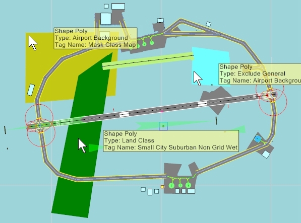
In Fig. 2 my test setup is shown.
Fig. 2: Test Setup
In this picture there are the following polygones (colour: type => tag)
- lightblue:
....... ExcludeGeneral => Airport Background
- yellow: :
... ....AirportBackground => MaskClassMap
- green: :
..... .. Landclass => varoius tags (my test objects)
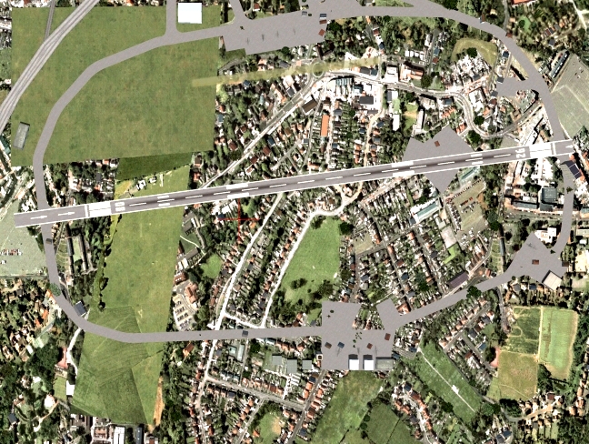
The following pictures show the above mentioned behaviours.
Fig. 3: The landclass „ Sand Desert“ is partially obscured by the poly „MaskClassMap“
Fig.4: the landclass „Broadleaf Crops“ is totally obscured by the poly „MaskClassMap“
Fig. 5: the landclass „SemiDesertSage“ is visible over the poly „LandClassMap“
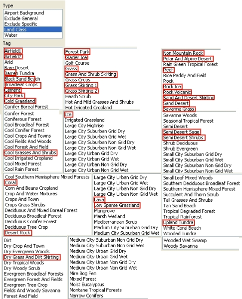
In the following table of all 123 „Landclass“-tags the only 32 totally visible tags are marked in red.
This experiment demonstrates that for Terrain Elements not only the sequence of layering is important, but also the selection of the polygones, because they react in a very unexpected way, which is not documented anywhere.
Before such a documentation is generated, I can only promote an advice, which Jim Vile gave me (together with a reference to the theoretical background, which is very complex):
........................................Don't overlap
Helli


 .
.

 Why would you want mangrove to grow on rock?