- Messages
- 6,536
- Country

paint.net TIFF exports the geotiff data intact as well.
Any other question that is not specific to an aspect of development or tool can be posted in the General chat forum.
By following these guidelines we make sure that the forums remain easy to read for everybody and also that the right people can find your post to answer it.


Thanks for the quick reply. That seems to have fixed it somewhat, but it's still a bit too high:I added scaling. Replace your current msfs_elev.py with the latest one from https://github.com/noolaero/msfs-toolkit and add -scale 0.3048 argument. This will scale units from feet to meters.
Sent.Please send me the DEM file, I am unable to download it directly (connection times out).

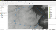
Would it be a possibility to add backwards compatibility for this so that you could do either method? Or has this been supported already in a version prior to adding the kml method? Using the kml is a great idea for simplicity, but in many cases, I end up creating a fairly complex blendmask that just wont translate over with the same results. In order to reduce file size as much as possible, I will typically remove areas of imagery that will not be seen.Existing transparency is ignored. Instead a new transparency channel is created based on shapes given with -border <file> and blending radius given with -blend <m>.
This means you don't need to manually mask aerial imagery. Just draw appropriate polys.
If you can make that work, that would be great! I doubt I'm the only one that uses this method to get rid of some unneeded bulk. The previous aerial I did, I was able to shave ~30% off of the CGL size by doing that. Depending on the coverage area, that's a lot of savings to pass up (At least, when you worry about file size).Manually applied blending has never been supported.
Tiles outside your export area or inside and with no visible pixels are automatically skipped over and not written to output folder. You end up with only the PNGs your project actually uses.
I may be able to fairly easily add support for pre-existing transparency, but I need to test it before I can say anything firm.
")
msfs elev -imagery "S:\flightsim\scenery\MSFS\freeware\PATK-Talkeetna-v2\Data\DEM\*.tif" -border "S:\flightsim\scenery\MSFS\freeware\PATK-Talkeetna-v2\Data\DEM\patk_3m_dem.shp" -airport "S:\flightsim\scenery\MSFS\freeware\PATK-Talkeetna-v2\Package\PackageSources\data\PATK.xml" -res 3 -falloff 300 -nodefo "S:\flightsim\scenery\MSFS\freeware\PATK-Talkeetna-v2\Package\PackageSources\data\PATK.xml" github.com
Thank you!
v0.52 is out:

Release v0.52 · noolaero/msfs-toolkit
elev tool: Added -scaling and -offset to allow conversions from feet to meters. Changed resolution from Web Mercator meters to true meters. Web Mercator resulted in higher resolution than requeste...
It switches to the new version of OSGeo4W tools and needs to re-download them. To speed up downloads, we've set up our own mirror server that cuts OSGeo4W install time from 25 minutes down to 3 minutes.


msfs.bat elev -imagery "D:\tmp\GIS\Canary\WGS84\LaGomeraMare.tif" -border "D:\tmp\GIS\Canary\WGS84\LaGomera.kml" -exclude "D:\tmp\GIS\Canary\WGS84\AeroLaGomera.kml" -fillnodata -dump "D:\tmp\GIS\Canary\WGS84\AeroLaGomera.shp" -res 2 "D:\tmp\GIS\msfs-toolkit\CanaryDEM2M\PackageSources\scene\LaGomera.xml"