-
Which the release of FS2020 we see an explosition of activity on the forun and of course we are very happy to see this. But having all questions about FS2020 in one forum becomes a bit messy. So therefore we would like to ask you all to use the following guidelines when posting your questions:
- Tag FS2020 specific questions with the MSFS2020 tag.
- Questions about making 3D assets can be posted in the 3D asset design forum. Either post them in the subforum of the modelling tool you use or in the general forum if they are general.
- Questions about aircraft design can be posted in the Aircraft design forum
- Questions about airport design can be posted in the FS2020 airport design forum. Once airport development tools have been updated for FS2020 you can post tool speciifc questions in the subforums of those tools as well of course.
- Questions about terrain design can be posted in the FS2020 terrain design forum.
- Questions about SimConnect can be posted in the SimConnect forum.
Any other question that is not specific to an aspect of development or tool can be posted in the General chat forum.
By following these guidelines we make sure that the forums remain easy to read for everybody and also that the right people can find your post to answer it.
You are using an out of date browser. It may not display this or other websites correctly.
You should upgrade or use an alternative browser.
You should upgrade or use an alternative browser.
Problem with Google Earth Decoder
- Thread starter Frank
- Start date


I doubt there is any support for GEDOT and related utility software, but here is info I found and discussed:
https://www.google.com/search?q=sit...oyLTEuMTMuNi4xyAf1AoAIAQ&sclient=gws-wiz-serp
FlyingTheston's YouTube tutorials have all been made "private" now, including a related video; one might wonder what his intent was / is ...in doing that ?
GaryGB
https://www.google.com/search?q=sit...oyLTEuMTMuNi4xyAf1AoAIAQ&sclient=gws-wiz-serp
FlyingTheston's YouTube tutorials have all been made "private" now, including a related video; one might wonder what his intent was / is ...in doing that ?
GaryGB
- Messages
- 6,572
- Country

What is the "small town" location ?
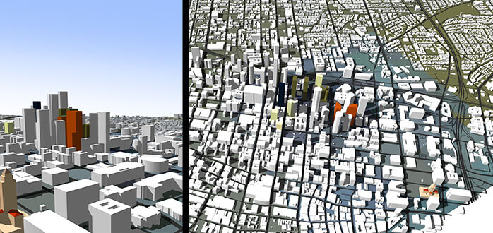
3D Tile data sets are available in some- but not all- areas of the globe; generally, urban areas have more comprehensive coverage, but not rural areas.
You need to ensure what imagery, terrain, and LiDAR data sets may be available locally, to justify the work (versus using MSFS' default photogrammetry).
GaryGB
Last edited:

Indeed, MSFS is surprisingly inaccurate for that scenic and rather well-developed urban area, for both buildings and shorelines.
I agree you may benefit from using Google's 3D Tiles, as MSFS' photogrammetry and Blackshark AI OSM coverage is very limited.
If you read all the info on the very interesting and highly capable Blender BLOSM plugin (and other related software) cited above, it becomes clear one would be able to achieve quite a realistic render of such a Geographic area.
[EDITED]
The Buildify application apparently has the potential to utilize data sources to make awesome and illuminated buildings in tandem with BLOSM:
https://paveloliva.gumroad.com/l/buildify
https://docs.google.com/document/d/...W7Cit-G-Q/edit?tab=t.0#heading=h.flj86qbo0n04
One may end up with a data overload to decimate, as the Bregenz area tile group alone, would be 6 to 12 - 1/2 Kilometer tiles.
As you read about the GEDOT addon, various LOD outputs are achievable, and in-flight Altitude LODs require less complex tiles.
But in MSFS from on ground, maximum LOD complexity looks best, so one must decide on an output LOD target.
Also, be aware that Google 3D tiles via GEDOT methods will have no night lights; I do not know if BLOSM itself can 'mod' 3D tiles (but IIUC, an export path via Buildify can).
If you manually light Bregenz by adding "Orbs" and/or custom placed streetlights, you may compensate for night light issues when a GEDOT output path is used with Google 3D tiles.
Another caveat with GEDOT methods is what size of 3D tile to make, so that per 3D object ModelPart sub-tiles can be more easily excluded to allow exclusion of such tiles via ExclusionRectangles, followed by replacement with high resolution custom 3D models.
If such GEDOT 3D tiles are made too large, one must exclude and replace much larger extents of photogrammetric "3D Ground Polygons", requiring greater expanses of replacement 3D models to be made.
Of course one might also use the Google Earth Studio and API:
https://earth.google.com/studio/docs/best-practices/
And one could also do this by using a Ruby plugin script in Sketchup such as PlaceMaker:
 www.suplacemaker.com
[END_EDIT].
Bregenz could be a very interesting- and very time consuming- project, but it certainly does deserve some more TLC in MSFS.
GaryGB
I agree you may benefit from using Google's 3D Tiles, as MSFS' photogrammetry and Blackshark AI OSM coverage is very limited.
If you read all the info on the very interesting and highly capable Blender BLOSM plugin (and other related software) cited above, it becomes clear one would be able to achieve quite a realistic render of such a Geographic area.
[EDITED]
The Buildify application apparently has the potential to utilize data sources to make awesome and illuminated buildings in tandem with BLOSM:
https://paveloliva.gumroad.com/l/buildify
https://docs.google.com/document/d/...W7Cit-G-Q/edit?tab=t.0#heading=h.flj86qbo0n04
One may end up with a data overload to decimate, as the Bregenz area tile group alone, would be 6 to 12 - 1/2 Kilometer tiles.
As you read about the GEDOT addon, various LOD outputs are achievable, and in-flight Altitude LODs require less complex tiles.
But in MSFS from on ground, maximum LOD complexity looks best, so one must decide on an output LOD target.
Also, be aware that Google 3D tiles via GEDOT methods will have no night lights; I do not know if BLOSM itself can 'mod' 3D tiles (but IIUC, an export path via Buildify can).
If you manually light Bregenz by adding "Orbs" and/or custom placed streetlights, you may compensate for night light issues when a GEDOT output path is used with Google 3D tiles.
Another caveat with GEDOT methods is what size of 3D tile to make, so that per 3D object ModelPart sub-tiles can be more easily excluded to allow exclusion of such tiles via ExclusionRectangles, followed by replacement with high resolution custom 3D models.
If such GEDOT 3D tiles are made too large, one must exclude and replace much larger extents of photogrammetric "3D Ground Polygons", requiring greater expanses of replacement 3D models to be made.
Of course one might also use the Google Earth Studio and API:
https://earth.google.com/studio/docs/best-practices/
And one could also do this by using a Ruby plugin script in Sketchup such as PlaceMaker:
PlaceMaker - Instant 3D City Builder
PlaceMaker lets you instantly build 3D cities in SketchUp, Revit, Rhino, Blender, and more! Import buildings, trees and forests. Place 3D roads, paths and water. Model directly onto 3D terrain. Learn more.
www.suplacemaker.com
[END_EDIT].
Bregenz could be a very interesting- and very time consuming- project, but it certainly does deserve some more TLC in MSFS.
GaryGB
Last edited:
The GitHub for Google Earth Decoder Optimization Tools (aka "GEDOT") by Alex Marko (aka "thalixte") is here:
https://thalixte.github.io/Google-Earth-Decoder-Optimization-Tools/
Although I do not personally use this workflow in my MSFS projects, I would say it has the best developed features currently available, with numerous options for control.
For a large extent of coverage such as Bregenz, GEDOT may offer the most practical method of porting content from your designated source into MSFS via Blender.
Be aware GEDOT has options allowing for control of whether lights are implemented, and inclusion, exclusion- as well as size- of MSFS glTF output tiles / ModelParts.
It is important to decide which tiles to include / exclude, as this impacts whether / how one substitutes local placement of one's own custom high resolution 3D models.
Otherwise the tile size and location of GEDOT objects and ModelParts may allow more or less of one's own custom high resolution 3D models to be used as replacements.
You may wish to review this thread to see challenges encountered in retro-fitting ExclusionRectangles into GEDOT scenery to allow use of replacement scenery content:
https://www.fsdeveloper.com/forum/t...-from-a-3rd-party-photogrammetry-area.459478/
Your personal preferences as to time of flights may be your guide in decisions for / against- implementing lights at night.
Your in-flight altitude may be your guide as to decisions for / against implementing more / less detail in capture of 3D object geometry and textures for LODs / MIPMAPs.
Many FS flyers stay above 3000 Feet AGL, and thus will not require highly detailed data capture, as the LOD / MIPMAP system in MSFS may not allow display of high detail.
Personally, I tend to do a lot of very low altitude sight-seeing ('low-and-slow'), so I appreciate high detail scenery; but that is a challenge to create for some developers.
I hope this helps with your consideration of how you may wish to proceed with your project.")
GaryGB
https://thalixte.github.io/Google-Earth-Decoder-Optimization-Tools/
Although I do not personally use this workflow in my MSFS projects, I would say it has the best developed features currently available, with numerous options for control.
For a large extent of coverage such as Bregenz, GEDOT may offer the most practical method of porting content from your designated source into MSFS via Blender.
Be aware GEDOT has options allowing for control of whether lights are implemented, and inclusion, exclusion- as well as size- of MSFS glTF output tiles / ModelParts.
It is important to decide which tiles to include / exclude, as this impacts whether / how one substitutes local placement of one's own custom high resolution 3D models.
Otherwise the tile size and location of GEDOT objects and ModelParts may allow more or less of one's own custom high resolution 3D models to be used as replacements.
You may wish to review this thread to see challenges encountered in retro-fitting ExclusionRectangles into GEDOT scenery to allow use of replacement scenery content:
https://www.fsdeveloper.com/forum/t...-from-a-3rd-party-photogrammetry-area.459478/
Your personal preferences as to time of flights may be your guide in decisions for / against- implementing lights at night.
Your in-flight altitude may be your guide as to decisions for / against implementing more / less detail in capture of 3D object geometry and textures for LODs / MIPMAPs.
Many FS flyers stay above 3000 Feet AGL, and thus will not require highly detailed data capture, as the LOD / MIPMAP system in MSFS may not allow display of high detail.
Personally, I tend to do a lot of very low altitude sight-seeing ('low-and-slow'), so I appreciate high detail scenery; but that is a challenge to create for some developers.
I hope this helps with your consideration of how you may wish to proceed with your project.
GaryGB
Last edited:
Hello Gary,
many thanks for your substancial reply, I appreciate this!
Hoping not to bore you, a little presonal Background. I started flightsimming with Bruce Artwick's Sublogic release … early infected, so to speak. In 2003 I started my own Projects: 'LUNAR Pilot' was released 2005.
Microsoft's ACES Studio was quite impressed and invited me to Redmond in 2005. 2007 they contraced me to build the Edwards AFB for 'FSX Acceleration', by the way still 1:1 in use in all versions of Prepar3d.
Yet, those were the days of .bgl and Max3ds … and there I remained. Anyway, I found my way back into FS, but just to encounter completely new realities. Well, a layman again.
------
Back to my topic:
a/ My fleet fits in a nutshell.:
I fly the LLRV in FS9, my A-320 in P3D and my SA-315 LAMA in MSFS 24.
b/ I have this huge area now open in Blender 3.5, 13000 tiles plus textures. I did not gather them with GE Decoder,
it was a payware app. Does this matter?
If not I just will follow your educational narrative and, if I may, rather most likely than perhaps … ask for help and instructions.
All in good moods and many thanks again.
Frank
Last edited:
Many thanks for your years of skilled contributions to FS; I can still recall the Lunar Lander package announcements back then.Hello Gary,
many thanks for your substancial reply, I appreciate this!
Hoping not to bore you, a little presonal Background. I started flightsimming with Bruce Artwick's Sublogic release … early infected, so to speak. In 2003 I started my own Projects: 'LUNAR Pilot' was released 2005.
Microsoft's ACES Studio was quite impressed and invited me to Redmond in 2005. 2007 they contraced me to build the Edwards AFB for 'FSX Acceleration', by the way still 1:1 in use in all versions of Prepar3d.
Yet, those were the days of .bgl and Max3ds … and there I remained. Anyway, I found my way back into FS, but just to encounter completely new realities. Well, a layman again.
Most of our FS2Kx SDK knowledge can still prove useful in MSFS development.
")
I have this huge area now open in Blender 3.5, 13000 tiles plus textures. I did not gather them with GE Decoder,
it was a payware app. Does this matter?
If not I just will follow your educational narrative and, if I may, rather most likely than perhaps … ask for help and instructions.
All in good moods and many thanks again.
Frank
If you review the GEDOT Prerequisites, and click links provided, IIUC, Alex links to a download of an updated freeware "Release":
Inside that ZIP is an executable: Earth2MsfsWPF.exe
I have not yet attempted to walk through the complete process presented on Alex' GEDOT website:
https://thalixte.github.io/Google-Earth-Decoder-Optimization-Tools/
...however, it is possible that if one goes through it in detail, one may see it uses a 'gratis' feature set for the entire process.

GaryGB
Last edited:
Many thanks again!
The GEDOT-Addon is installed, yet, now I'm stuck.
Can you decipher the line within the red rectangle?
I can find the packagetool.exe in my SDK folder,
but how can I couple it with the Blender addon-section?
It does not show up there. And, it is no .zip-file as one
would expect ...
Hoping that I'm no painin the neck,
with best regards
Frank
Attachments

Hi Frank:
[EDITED]
IIUC, Alex refers to setting up GEDOT as an add-on in Blender 3.5.1.
I am thus far unable to get his MP4 video files to play properly in my current reinstall of Windows 10.
AFAIK, on the prior GEDOT "Prerequisites" web page, Alex regards his current build of GEDOT on flightsim.to:
...as the "update" source for a file used to over-write the GoogleMapsTools.dll in this Google Earth Decoder Tool folder:
After doing that and other tasks on GEDOT "Prerequisites" web page, one installs GEDOT as an Extension add-on in Blender 3.5.1
The other tasks appear to be simply finding and having available:
* FSPackageTool from MSFS SDK subfolder that Alex specifies on the GEDOT "Prerequisites" web page
* AMD Compressonator from the linked, downloaded, and de-archived "compressonatorcli-4.5.52-win64.zip" ZIP file package
[END_EDIT]
To better understand what he is doing, I would need to actually set this up and watch his (2) linked videos on that GEDOT page:
https://thalixte.github.io/Google-Earth-Decoder-Optimization-Tools/installation/installation/
https://thalixte.github.io/Google-Earth-Decoder-Optimization-Tools/assets/videos/installation.mp4
https://thalixte.github.io/Google-Earth-Decoder-Optimization-Tools/assets/videos/installation.mp4
I presently am on my way out until this evening (Chicago USA - Central Time Zone).
But I may otherwise be able to look at this in Blender 3.5.1 by tomorrow evening.
GaryGB
Last edited:
Hi Gary,
I managed to move on, at least a little bit.
I decided to extract a small, central portion of the city,
just to keep the loads small.
GEDOT works, at last for step one (setting up path, creating folders)
This is where I got stuck ... as the folders are empty.
See my stuff attached.
Many thanks for your care!
Frank
Attachments
-
 Installed Blender Add-ons.jpg190 KB · Views: 102
 -
 Error 2.jpg197.6 KB · Views: 99
 -
 Contents of GEDOT folder.jpg35.4 KB · Views: 92
 -
 Error 1.jpg223 KB · Views: 104
 -
 Open Blender Test Project.jpg314.2 KB · Views: 133
 -
Bregenz Inner City (ini).txt1.1 KB · Views: 77
-
Bregenz inner city (xml).txt288 bytes · Views: 78
Hi Frank:
If I am following your tasks correctly, you have compelted tasks listed on this page of the GEDOT guide by thalixte:
https://thalixte.github.io/Google-Earth-Decoder-Optimization-Tools/installation/installation/
...and you are now proceeding into tasks listed on this page of the GEDOT guide by thalixte:
https://thalixte.github.io/Google-Earth-Decoder-Optimization-Tools/features/initialize_scenery/
Just so I know that you see- what I see- in my web browser, do you see both the videos and text on web pages I linked above ?
GaryGB
Last edited:
Hi Gary:
Yes, I see both videos and text.
Hm, talking about the second link you sent:
I did not retrieve the GE-data from Google Earth Decoder,
I fetched it from Open Earth Online. Exactly the same source (GE),
but obviously not the same outcome.
I did so, because I can not get Google Earth Decoder running.
Tried to install the downloaded 'release.zip' several times, to no avail.
I managed to import the tiles into blender, and all shows up nicely,
textures included. But the proccess seems to mandatorily require
Google Earth Decoder ...
No idea, if and how GEDOT could mate with my already acquired 2.7GB.
And then proceed (optimization/water exclusion etc.).
What can I do?
Best regards
Frank
Attachments

Alex' GEDOT uses scripted (Python) procedures to semi-automate data capture and processing via a specific file / folder structure.
AFAIK, one must use precisely what he specifies; in doing so, one gets the benefit of proper (and labor-saving) automation.
FYI: I was able to download and un-ZIP the "Release" ZIP and de-archive it into a folder, so we know the archive is online and valid.
I'll take another look at that process tomorrow later in the morning (Tuesday) Chicago time.
UPDATE:
IIUC, I may have used my usual custom-renaming protocol when I download / saved this (rather late at night):
https://github.com/Thalixte/Google-Earth-Decoder-Optimization-Tools/releases/tag/v2.0.6
See if you can sort that out for use in Alex' work flow, read his instructions carefully on all pages of his GEDOT GitHub pages:
https://thalixte.github.io/Google-Earth-Decoder-Optimization-Tools/installation/prerequisites/
I would not attempt using anything other than what Alex specifies (it should then be semi-automated for you using his scripts).
I should not speculate as to whether there are any work-arounds that do not follow Alex's specified downloads and folders / files.
GaryGB
Last edited: