• Which the release of FS2020 we see an explosition of activity on the forun and of course we are very happy to see this. But having all questions about FS2020 in one forum becomes a bit messy. So therefore we would like to ask you all to use the following guidelines when posting your questions:

    • Tag FS2020 specific questions with the MSFS2020 tag.
    • Questions about making 3D assets can be posted in the 3D asset design forum. Either post them in the subforum of the modelling tool you use or in the general forum if they are general.
    • Questions about aircraft design can be posted in the Aircraft design forum
    • Questions about airport design can be posted in the FS2020 airport design forum. Once airport development tools have been updated for FS2020 you can post tool speciifc questions in the subforums of those tools as well of course.
    • Questions about terrain design can be posted in the FS2020 terrain design forum.
    • Questions about SimConnect can be posted in the SimConnect forum.

    Any other question that is not specific to an aspect of development or tool can be posted in the General chat forum.

    By following these guidelines we make sure that the forums remain easy to read for everybody and also that the right people can find your post to answer it.

FS2004 Sbuilder9 Land Mask Polys Not Apearing

Messages
85
Country
us-georgia
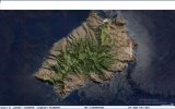
I have been experimenting and learning to place new coastlines and some photoscenery with Sbuilder. Specifically St. Helena Island. I have sucessfully added new coastlines to outline the island and added land and water masks/fills to define the water/land areas. I also added a photo map of the island and produced a photoscenery. My problem is there are a few squares that will not display the land mask. I have tried redrawing the water polys with no success. Wondering if there is something I am missing so the squares will display correctly. I have included a photo of Sbuilder screen and FS9 display of the island. The squares with no fill are on the upper and lower right and the lower left. All others appear to be working as planned. The second question is about removing old coastline sections. I made an exclude for the whole island and set to All. No progress there either.

Thanks in advance
 

Attachments

  • screenshot128.jpg
    screenshot128.jpg
    641.5 KB · Views: 55
Why didn't you click all rectangles to change them to green?
so only the green marked will create photo tiles.
 
Agreed. I had unclicked those just so I could look at all the coastline tiles without another overlay. I always check any tile with a land mask so it can be compiled. I have deleted land masks and reapplied then four or five times. Also, the water mask polygons, but nothing seems to change upon compiling. It's weird because all of the other tiles display properly.
 
I have also sometimes issues with SB9 when the scenery needs 2 areas or so.
I really believe of a bug.
No idea till now
 
I learned how to delete coastal segments also. One question I have is, can the polygons span more than on LOD square? Say I want to delete all default coastal segments around the island. Can it one large on or just within the designated LOD squares?
 
Hello:

There are indeed minimum content coverage extents required for successfully getting land and water class tiles to display in FS2Kx SDK; these appear sometimes to be a "bug" because they require some overlap of source data into adjacent quads.

Although the author of SBuilder did explain these concepts in an old pair of posts at AVSIM and PTSIM websites years ago, they are rather technical.


Consider using rhumbaflappy's Longitude Extents Calculator (LEC); search the forums for that utility and the related PhotoCalc:

https://www.google.com/search?q=sit...cIMC4yLjEzLjLIB1I&sclient=mobile-gws-wiz-serp

GaryGB
 
Last edited:
I tried to find the LEC you referred to, but no luck. Probably to old. i did find Photocalc. Might attempt more with this later. Right now I am using a scenery from Carlyle Sharpe.
 
SBuilderX:

* Configured at Zoom level 14

* LOD-14 TMF Quad Grid displayed

* Extents of LOD-14 TMF Quad Grid allows Zoom level 18 tile download groups that do not exceed SBuilderX work set size, and allow max. tile image size without a crash:

st_helena_island_sbuilderx_msve_imagery_lod-14_grid-1-jpg.97571


If made for FSX, there would be 10 downloads of 1.2 GB max. that compile to (2) BGLs of max. 2 GB each output at 'least lossy' 100% compression.

If you do not use FSX, FS9 would be limited to 32X less resolution for aerial imagery.


In SBuilderX:

* Log coordinates at centers of LOD-14 quads

* 'Go To Position' at center of each LOD-14 quad for each tile download at Zoom 14

* Target resolution at Zoom level 18 during each tile download for the resulting aerial imagery.


Use a multi-source INF, and SDK Resample will automatically eliminate overlaps, while it stitches and stretches source images to quad corners.


For the laborious manual calculation of extents for a multi-source INF without using SBuilderX, one 'could' use these utilities:

LEC - Download: https://www.fsdeveloper.com/forum/attachments/lec-zip.97568/?hash=7af5296a57003045023b2a26cdcea1f5


https://www.google.com/search?q=site:+www.fsdeveloper.com+LEC+LOD+Extents+Calculator&client=firefox-b-1-e&sca_esv=465159d7bf2b0b64&channel=entpr&ei=V5qwaLzCI4Lgp84PhYrHoQ4&ved=0ahUKEwj8ycv4i66PAxUC8MkDHQXFMeQQ4dUDCBA&oq=site:+www.fsdeveloper.com+LEC+LOD+Extents+Calculator&gs_lp=Egxnd3Mtd2l6LXNlcnAiNHNpdGU6IHd3dy5mc2RldmVsb3Blci5jb20gTEVDIExPRCBFeHRlbnRzIENhbGN1bGF0b3IyBRAhGKABMgUQIRigATIFECEYoAFI2sMBUKglWLq6AXADeACQAQCYAbUBoAGeA6oBAzAuM7gBDMgBAPgBAvgBAZgCBaAC4gLCAg4QABiABBiwAxixAxiDAcICDRAAGIAEGLADGEMYigXCAggQABiABBiwA8ICCxAAGIAEGLADGLEDwgIREAAYgAQYsAMYsQMYgwEYigXCAg4QABiwAxjkAhjWBNgBAcICFxAuGIAEGLADGLEDGNEDGMcBGMgD2AEBwgIOEC4YgAQYsAMYyAPYAQHCAggQABiABBiiBMICBRAAGO8FmAMAiAYBkAYTugYGCAEQARgJkgcDMy4yoAfRB7IHAzAuMrgHtALCBwUyLTIuM8gHMw&sclient=gws-wiz-serp


PhotoCalc - Download: https://www.fsdeveloper.com/forum/a....97569/?hash=7af5296a57003045023b2a26cdcea1f5

https://www.google.com/search?q=site:+www.fsdeveloper.com+PhotoCalc&client=firefox-b-1-e&sca_esv=465159d7bf2b0b64&channel=entpr&ei=c5qwaKOyE_iFp84P0ZHWiQI&ved=0ahUKEwjjt-iFjK6PAxX4wskDHdGINSEQ4dUDCBA&oq=site:+www.fsdeveloper.com+PhotoCalc&gs_lp=Egxnd3Mtd2l6LXNlcnAiI3NpdGU6IHd3dy5mc2RldmVsb3Blci5jb20gUGhvdG9DYWxjMgUQIRigATIFECEYoAEyBRAhGKABMgUQIRigAUjnRVDcB1iXMHABeACQAQCYAa4BoAHIC6oBBDAuMTG4AQzIAQD4AQGYAgagAvcFwgIIEAAYsAMY7wXCAgUQABjvBcICChAhGKABGMMEGAqYAwCIBgGQBgGSBwMxLjWgB4oisgcDMC41uAfxBcIHBTAuMi40yAcQ&sclient=gws-wiz-serp
 

Attachments

  • LEC.zip
    LEC.zip
    10.5 KB · Views: 53
  • PhotoCalc.zip
    PhotoCalc.zip
    327.7 KB · Views: 59
  • St_Helena_Island_SBuilderX_MSVE_Imagery_LOD-14_Grid-1.jpg
    St_Helena_Island_SBuilderX_MSVE_Imagery_LOD-14_Grid-1.jpg
    221.2 KB · Views: 82
Last edited:
Back
Top