• Which the release of FS2020 we see an explosition of activity on the forun and of course we are very happy to see this. But having all questions about FS2020 in one forum becomes a bit messy. So therefore we would like to ask you all to use the following guidelines when posting your questions:

    • Tag FS2020 specific questions with the MSFS2020 tag.
    • Questions about making 3D assets can be posted in the 3D asset design forum. Either post them in the subforum of the modelling tool you use or in the general forum if they are general.
    • Questions about aircraft design can be posted in the Aircraft design forum
    • Questions about airport design can be posted in the FS2020 airport design forum. Once airport development tools have been updated for FS2020 you can post tool speciifc questions in the subforums of those tools as well of course.
    • Questions about terrain design can be posted in the FS2020 terrain design forum.
    • Questions about SimConnect can be posted in the SimConnect forum.

    Any other question that is not specific to an aspect of development or tool can be posted in the General chat forum.

    By following these guidelines we make sure that the forums remain easy to read for everybody and also that the right people can find your post to answer it.

P3D v4 Why Does This Airport Not Work

Messages
967
Country
us-northcarolina
I have created an airport for FSX that works perfectly in FSX and has for the past month. Now that I am on Windows 10 and have P3D V4.5 installed I would like to use it here. So, I opened it up in ADEx P3DV4 and added the buildings to the library (all created in Sketchup 2017 and Model ConverterX for bgls). I copy the airport into Addon Scenery in LM P3DV4.5 and install it correctly with the Scenery Tab just as I have other airports I created for FSX WITHOUT compiling them for P3D and they work perfectly. After installing it into the Scenery Library I go to select it and its not there. In FSX the scenery.cfg would show it was being added. P3D does not. It just says close. Why is this not being added? What am I doing wrong. I am attaching the airport folder which belongs to me so I can share it. It's too large so here is a mediafire link to it:

https://www.mediafire.com/file/zujzk752b4mzcf6/WV82+Cox+Lane+Field_P3D.zip/file
 
Messages
7,450
Country
us-illinois
Hello:

I am able to load the package into P3Dv4.5 Scenery Library via:

P3Dv4.5 GUI > Scenery > [Add Area] > Browse to package location > select top folder: "WV82 Cox Lane Field_P3D" > click [OK]


Terrain: "It's the pits", because IIUC, you did not yet set an Altitude for your Airport Boundary flatten polygon in: WV82_ADEX_RRL_CVX.bgl

This is a *.BLN output by CvxExtractor from your file cited above; 3rd field in the XYZ-format records is Altitude (X=Lon, Y=Lat, Z=Alt)

6,1,AirportBounds_0_0
-78.7513661384583,39.1764092445374,0
-78.7505793571472,39.1828519105911,0
-78.750536441803,39.1828519105911,0
-78.7534046173096,39.1830343008041,0
-78.7543344497681,39.1765916347504,0
-78.7513661384583,39.1764092445374,0

[EDITED]

If an Altitude is not specified for any Aiport Background (or Hydro) Polygon, it will by default "fall back" to an Altitude of 0 Meters AMSL.

https://www.prepar3d.com/SDKv4/sdk/world/terrain/terrain_overview.html#The Shp2Vec Tool

"This requires 3D vertices, otherwise this entry will cut deep holes in the landscape. Note there is no special attribute to indicate this requirement."

https://learn.microsoft.com/en-us/p...soft-esp/cc707102(v=msdn.10)#the-shp2vec-tool

See:

* AirportBounds

* WaterPolys

[END_EDIT]


To fix this, you can:

1.) Copy and Paste into NotePad

2.) Save with a .BLN file extension

3.) Append to SBuilderX

4.) Select and in Properties, Edit the Altitude

5.) Select and in Properties, apply to the polygon, the SBuilderX attribute list item Type 148 for this CVX vector GUID:

{46bfb3bd-ce68-418e-8112-feba17428ace} Flatten + MaskClassMap + ExcludeAutogen

6.) Select and in SBuilderX Menu > File, Compile a CVX vector BGL.


Of course, if you still have the *.AD4 project file, you can edit the original polygon Altitude in ADE, then compile it to BGL via a 'split compile'.

wv82_p3dv45x_-jpg.87043


FYI: This is an excerpt from another thread, quoted as an example of the process I use to 'Add Area' in FSX.

< IIRC, I did not have to do the "White space click trick" in P3Dv4.5, whereas FSX requires that extra step listed below :alert: >


"In FSX GUI Menu > Scenery Library > Add Area > Browse to:

[FSX install path]\Addon Scenery\FSX_LEPA_RS\ sub-folder


Left-click once in the 'white' area near the \Scenery and \Texture sub-folders


Left-click once on the [OK] button


Left-click once again in the 'white' area near the \Scenery and \Texture sub-folders


NOTE: Scenery Library should now be closed and allowed to re-index


FSX GUI Menu > Free Flight > Launch a flight at LEPA;

Your scenery should all be displayed, assuming you have a properly installed FSX folder chain."

GaryGB
 

Attachments

  • WV82_P3Dv45x_.jpg
    WV82_P3Dv45x_.jpg
    739.9 KB · Views: 307
Last edited:
Messages
967
Country
us-northcarolina
The file as I have it works perfectly in FSX. It's P3DV4.5 that I don't understand having JUST started with it. Some things I have done just like I have done for 10 years learning all the while in FSX are the same and work. That is why I don't understand why some of my airports created identically like this one work perfectly in P3D and this one doesn't. I apologize but I am totally confused by your explanation what to do above.
 
Messages
967
Country
us-northcarolina
Actually I take back above. It can be uploaded to FSX, but unlike my FSX Acceleration installation on Windows 7, this is trash too and I blame 10 and FSX who don't play nice together. AND since it doesn't want to work on my system in P3D V4.5, I am just going to forget it and move on to the new airport I have just started working on KMGW that I had created two years ago with the help of the airport and got lost before I was done with it totally when the other Windows Laptop got totally fried. I learned the hard way to update daily everything I was working on onto a flash drive and not lose anything ever again. More stuff on there got lost too. That is when I setup the desktop with Windows 10 which was just a business computer before. It gabve me the opportunity though with the TB of hard disk and P3D V4.5 NOT using CPU but GPU. I just have to learn howto create my scenery for it. Thank you for your help but let's just let this go. Good luck with your power supply.
 
Messages
7,450
Country
us-illinois
The file as I have it works perfectly in FSX. It's P3DV4.5 that I don't understand having JUST started with it. Some things I have done just like I have done for 10 years learning all the while in FSX are the same and work. That is why I don't understand why some of my airports created identically like this one work perfectly in P3D and this one doesn't. I apologize but I am totally confused by your explanation what to do above.

Actually I take back above. It can be uploaded to FSX, but unlike my FSX Acceleration installation on Windows 7, this is trash too and I blame 10 and FSX who don't play nice together. AND since it doesn't want to work on my system in P3D V4.5, I am just going to forget it and move on to the new airport I have just started working on KMGW that I had created two years ago with the help of the airport and got lost before I was done with it totally when the other Windows Laptop got totally fried. I learned the hard way to update daily everything I was working on onto a flash drive and not lose anything ever again. More stuff on there got lost too. That is when I setup the desktop with Windows 10 which was just a business computer before. It gave me the opportunity though with the TB of hard disk and P3D V4.5 NOT using CPU but GPU. I just have to learn how to create my scenery for it. Thank you for your help but let's just let this go. Good luck with your power supply.
No Problem.

FYI: With some (a lot, actually) of patience, eventually Windows-10 can be "domesticated" to function almost exactly like Windows-7. :coffee:

BTW: Here's the "WV82 Cox Lane Field_P3D" package loaded in FSX on my Windows -10 installation... :idea:

Yep, in FSX I had to do the "White space click trick" in FSX Scenery Library > Add Area to get it to load into the stack of Area layers. :pushpin:

wv82_fsx_-jpg.87048


GaryGB
 

Attachments

  • WV82_FSX_.jpg
    WV82_FSX_.jpg
    582.5 KB · Views: 278
Last edited:
Messages
967
Country
us-northcarolina
When I opened it up in FSX it is not at all like it is supposed to look in Google Earth or real life for that matter so although the airport was created as best as it could be, typically ACES in their infinite wisdom did not create the earth as it should be so the airport looks stupid to me as you can see with the elevation. It is NOT in a valley. I am going to call it quits and try and see if I have better luck with KGMW in West Virginia. Thank you Gary for taking your time to try and help but sometimes it just doesn't work out like it should. I am going to let this go.
 
Messages
133
Country
switzerland
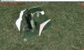
From your AD4 file I could see the flatten has altitude 0, the airport itself is at 2082.999 ft. The canyon is made by the wrong altitude in the flatten. That's all.

I also removed the photo1.bgl from the directory, cause it gave me a whiteish background.
2023-3-12_5-51-0-609.jpg


I don't understand why you added two ad4 files. I reworked the newer. The beacon was in the middle height of the tower, the tower view was a few miles away. Also the tower was out of the center and that makes it difficult to place other objects on it. Since it has not transparent windows, i set the tower view 20 feet higher. If you remove the beacon maybe, you could place the tower view there instead.

Generally this airfield could be made with sloped runway in P3D5. For v4.5 I'd recommend to adjust the flatten to the minimum, creating a shape just to encircle the buildings and the runway to create the right impression of the landscape there.

Don't know if you can use my .bgl files since they are compiled with v5 sdk. In this case you can just use the .ad4 file to compile. The tower can be centered by just using MCX and center it there with the move function. It has a center button. Then save again as scenery or if you're not able to do it, just move the tower, beacon and tower view again to its former position.

Regards

Dan

2023-3-12_8-7-16-194.jpg
 

Attachments

  • WV82 Cox Lane Field_P3D5.zip
    99.2 KB · Views: 47
Messages
967
Country
us-northcarolina
From your AD4 file I could see the flatten has altitude 0, the airport itself is at 2082.999 ft. The canyon is made by the wrong altitude in the flatten. That's all.

I also removed the photo1.bgl from the directory, cause it gave me a whiteish background.
View attachment 87062

I don't understand why you added two ad4 files. I reworked the newer. The beacon was in the middle height of the tower, the tower view was a few miles away. Also the tower was out of the center and that makes it difficult to place other objects on it. Since it has not transparent windows, i set the tower view 20 feet higher. If you remove the beacon maybe, you could place the tower view there instead.

Generally this airfield could be made with sloped runway in P3D5. For v4.5 I'd recommend to adjust the flatten to the minimum, creating a shape just to encircle the buildings and the runway to create the right impression of the landscape there.

Don't know if you can use my .bgl files since they are compiled with v5 sdk. In this case you can just use the .ad4 file to compile. The tower can be centered by just using MCX and center it there with the move function. It has a center button. Then save again as scenery or if you're not able to do it, just move the tower, beacon and tower view again to its former position.

Regards

Dan

View attachment 87061
I am going to try this a little later after church today and thank you for taking all this trouble. I hope that it works from your bgls too. I tried removing the photo01 too but that didn't help me. I will post my results this afternoon.
 
Messages
133
Country
switzerland
You can just load my ad4 file and compile it. Photo01.bgl you can just rename to .off to disable it. If you use my ad4, I used the centered tower. So that differs a bit from your one. It was handier to place the beacon on it. So the tower is in the zip too. It's compiled with v5 compiler but it should work fine in v4.5 i guess.
 
Messages
7,450
Country
us-illinois
From your AD4 file I could see the flatten has altitude 0, the airport itself is at 2082.999 ft. The canyon is made by the wrong altitude in the flatten.

Indeed, with WV82_ADEX_RRL.AD4 loaded in ADE, we see Airport Boundary / Background Polygon (aka "ABP") Altitude = 0:

wv82_fsx_ade_cvx_abp-1-jpg.87064


The Altitude of the corner vertices of the ABP should be blended into surrounded terrain using a Terrain 'skirt' of ABP Triangles.

The Altitude of the corner vertices of those ABP Triangles will vary with the actual terrain mesh to be used locally in FS at run time.


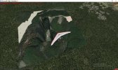
The screenshot below is from Google Earth, and shows that the WV82 local terrain is sloped.

The actual slope "shape" will vary according to which terrain mesh one has loaded in FS at run time.

Note that Google Earth mostly uses a low resolution (~90 Meters or less) terrain "mesh" in 3D view, so IRL the site is likely even more dramatically sloped (as is often the case with sites in the Appalachian Mountain Range).

wv82_ge-1-jpg.87065


FYI: KMGW is likely to be even more demanding when it comes to blending the airport area into surrounding terrain.

These airports can be more accurate with less work on blending ABP sloped flattens, if one uses more accurate terrain mesh.


AFAIK, if one wishes to make this airport RWY slope reasonably accurate to its shape in real life, one must abandon use of A.I. Traffic. :pushpin:

Then one can use custom photo-real imagery land class on top of terrain mesh, with only Start Locations ...and no ADE "flat" RWY.


But as Dan points out, if one uses P3Dv5, one may implement sloped "paved" RWYs.

That said, I have yet to see whether that method of P3DV5 sloped RWYs still allows FS A.I. Traffic to operate on those sloped RWYs. :scratchch

GaryGB
 

Attachments

  • WV82_GE-1.jpg
    WV82_GE-1.jpg
    375.7 KB · Views: 245
  • WV82_FSX_ADE_CVX_ABP-1.jpg
    WV82_FSX_ADE_CVX_ABP-1.jpg
    213.5 KB · Views: 225
Last edited:
Messages
967
Country
us-northcarolina
This is way beyond my understanding probably because I have never done anything in P3D V4.5 or any other P3D for that matter. I first tried to open up the ADE file in my ADEx latest version and selected P3DEV4 as what to use and compiled it. Used those files in a scenery folder I created and added it to Scenery in P3DV4.5. It is added and as soon as I reopen scenery to check it is gone. So I used the blaunarwal bgls in a scenery folder added and it still does the same thing disappears. I really appreciate what you guys are trying to do but it is NOT going to work on my computer in my P3DV4.5 no matter we try to do so just forget it. All the work you do if I can't load it in is a moot point. Thank you both for all your efforts. This is one of those cases I have had though fortunately very infrequently that just won't work. So in the words of the general in WWII----NUTS!!!!
 
Messages
7,450
Country
us-illinois
I wonder if your 'active' user Scenery.Cfg file may have been toggled into Read Only mode by a recent Windows 10 security update ? :oops:

GaryGB
 
Messages
967
Country
us-northcarolina
Just for my own peace of mind, I copied my original FSX WV82 folder to my desktop; added it into the FSX Addon Scenery; added it in the Scenery and opened up my default Cessna at WV82 active runway. Here are two screen shots of it as it was on my other FSX system. It works the same on the Windows 10 FSX now too.
Image_230312_124521.jpg


Image_230312_124458.jpg


So I guess if I want to fly out of here it will just be in FSX which is ok since I don't do it very often. Again thanks for all your hard work to try and make it work in P3DV4.5
 
Messages
967
Country
us-northcarolina
I'm wondering if your 'active' user Scenery.Cfg file may have been toggled into Read Only mode by a recent Windows 10 update ? :oops:

GaryGB
That could be and I will check that. Everytime that Windows decides to do another update I know from friends in the past it messes up something when they try and fix something else. I'll go and see.
 
Messages
7,450
Country
us-illinois
AFAIK, on all Windows-10 FS user installations, the 'active' user Scenery.Cfg file path is:

FSX
C:\Users\All Users\Microsoft\FSX\scenery.cfg

P3DV4.5
:
C:\Users\All Users\Lockheed Martin\Prepar3D v4\scenery.cfg

GaryGB
 
Last edited:
Messages
967
Country
us-northcarolina
OK so I quit too soon...LOL...
AFAIK, on all Windows-10 FSX user installations, the 'active' user Scenery.Cfg file path is:

C:\Users\All Users\Microsoft\FSX\scenery.cfg

GaryGB
OK, I quit too soon. I found the scenery.cfg in P3D which is the problem child. When I checked the properties, the desktop user did not have permission to make changes, but they do now. Since this is MY computer in MY house I gave it full permission to change anything and when I put WV82P3DV5 version into P3D, the scenery.cfg was updated and it also is working great now no tunnels and the photo01 is as well. I will have to put my building bgls back into it so the special hangers etc are there but I will say thank you everyone for your help, suggestions and this is a closed topic all working well as I wanted it to do. Actually I needed to add my buildings and didn't realize that the P3DV5 wouldn't work so I opened up the ADEx file that Dan sent, compiled it, added it took OUT the photo01 and it is perfect now with the beacon at 120' agl which IS the top of that tower. Works for me! I don't believe that I can slope anything in PeDV4.5 just V5 which I am unable to run is that correct?
 
Last edited:
Messages
133
Country
switzerland
Indeed, with WV82_ADEX_RRL.AD4 loaded in ADE, we see Airport Boundary / Background Polygon (aka "ABP") Altitude = 0:


The Altitude of the corner vertices of the ABP should be blended into surrounded terrain using a Terrain 'skirt' of ABP Triangles.

The Altitude of the corner vertices of those ABP Triangles will vary with the actual terrain mesh to be used locally in FS at run time.


The screenshot below is from Google Earth, and shows that the WV82 local terrain is sloped.

The actual slope "shape" will vary according to which terrain mesh one has loaded in FS at run time.

Note that Google Earth mostly uses a low resolution (~90 Meters or less) terrain "mesh" in 3D view, so IRL the site is likely even more dramatically sloped (as is often the case with sites in the Appalachian Mountain Range).


FYI: KMGW is likely to be even more demanding when it comes to blending the airport area into surrounding terrain.

These airports can be more accurate with less work on blending ABP sloped flattens, if one uses more accurate terrain mesh.


AFAIK, if one wishes to make this airport RWY slope reasonably accurate to its shape in real life, one must abandon use of A.I. Traffic. :pushpin:

Then one can use custom photo-real imagery land class on top of terrain mesh, with only Start Locations ...and no ADE "flat" RWY.


But as Dan points out, if one uses P3Dv5, one may implement sloped "paved" RWYs.

That said, I have yet to see whether that method of P3DV5 sloped RWYs still allows FS A.I. Traffic to operate on those sloped RWYs. :scratchch

GaryGB
Hi Garry

I worked all day to make it slopened for v5. It works but you can't just follow the mesh you have, since this is not the slope from Google Earth. I had to create my own, man built terrain, which in reality is also the case. They did not just follow the terrain given but made some plane areas to place the buildings and also tried to reduce the slope of the runway. That in mind I got a pretty nice approach i think.
AI traffic at these airports, ok if you really want, but it is not necessary. It's just for user aircraft to my opinion. It makes it even harder to create taxiways. For user AC i only need to try-and-error-approach the slope i made with a flatten poly with the runway line, to make it look right. With taxiways for AI, I'd need to adjust even more points to height.

This is how it looks. Still busy creating some landmarks, with terrain mods too unfortunately. But for today it's time to close the workshop.

Regards

Dan

2023-3-12_20-33-24-142.jpg
 
Last edited:
Messages
133
Country
switzerland
@tgycgijoes How did it go with the files I made? Does it work in v4.5? I could compile for v4 I remember in ADE, just have to select v4 during start.

Do you mind, if I share the airfield for P3Dv5 as freeware on my page? I give you proper credit for the buildings and initial scenery.

Regards
Dan

 
Messages
967
Country
us-northcarolina
Hi Dan,

Please feel free to share it in gratitude for YOUR help. I use it in V4.5. Just credit me for what I did is enough. The WV82 is NOT an FAA ICAO but in order to use it in any sim it HAD to have a four character ICAO. Because the REAL airfield is unregistered and on private property it is not called anything. My friend who stores his Super Cub there (hence the name Neal's hanger) had to help find it by coordinates in Google Earth and "driving down the highways...turn right...now turn left...just a little further as if on GPS" and then I went from there in SBuilderX. Now you have the background when first I created it for FSX not having P3DV4.5 at that time. You can include the background in the README if you choose. FSX ACE's team did NOT include this portion of West Virginia in a snow belt so when I did the photoreal scenery seasonals the background was white and everything else around it green trees no roads or anything else. If you haven't looked at it in Google Earth go and see what the area in Kirby REALLY looks like and compare it to the area in V5. I would be curious. Also would like to see what it looks like in MSFS. I have Megascenery Earth West Virginia and it looks like it is supposed to and was placed perfectly to mesh, but only in the Spring/Summer not being seasonal.

Richard
 
Top