• Which the release of FS2020 we see an explosition of activity on the forun and of course we are very happy to see this. But having all questions about FS2020 in one forum becomes a bit messy. So therefore we would like to ask you all to use the following guidelines when posting your questions:

    • Tag FS2020 specific questions with the MSFS2020 tag.
    • Questions about making 3D assets can be posted in the 3D asset design forum. Either post them in the subforum of the modelling tool you use or in the general forum if they are general.
    • Questions about aircraft design can be posted in the Aircraft design forum
    • Questions about airport design can be posted in the FS2020 airport design forum. Once airport development tools have been updated for FS2020 you can post tool speciifc questions in the subforums of those tools as well of course.
    • Questions about terrain design can be posted in the FS2020 terrain design forum.
    • Questions about SimConnect can be posted in the SimConnect forum.

    Any other question that is not specific to an aspect of development or tool can be posted in the General chat forum.

    By following these guidelines we make sure that the forums remain easy to read for everybody and also that the right people can find your post to answer it.

New Ground Poly Tutorial for the year 2014

jtanabodee

Resource contributor
Messages
3,924
Country
thailand
Hi Everyone,


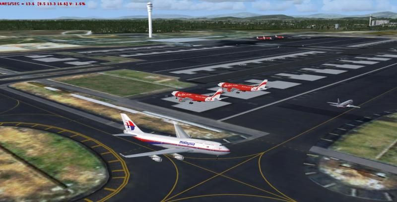
I think the most used tutorial is the ground poly tutorial from Bill Womack. It has been a while since he wrote this tutorial for us. There are a lot of new knowledge and tools to make it more accurate and easier than in the past. I would like to present this tutorial to be an add on to Bill's tutorial. Something has changed such as the length of runway CANNOT be the reference anymore. MCX has new tools such as Ground Polygon Wizard and Coordinate Converter that make life easier.
I have done it and separate into two parts. Click on the "Part..." and it will give you a link to download.
Part 1.
Step 1. Get satellite image to Gmax and use Co-ordinate tool form MCX to make reference plane.
Step 2 Make Grid for use with reference plane.
Step 3 Draw runway and taxiway.​
Part 2.
Step 4 Make runway and taxiway edge.
Step 5 Make taxi lines.
Step 6 Export to mdl and convert into ground poly using MCX.
I have finished part 1. Part2. will come later since next week since I have another busy task to do. I will come back with the Part 2

Try it and you will see how fast it could be done with less work load. I have finished seamless asphalt ground poly in about two hours in one afternoon.
Hope my tutorial can help you.
 
Last edited:
The part 1 link does not work for me. Get a blank about screen.

Edit:

works now
 
Last edited:
Very nice! I'm glad someone has taken the time to update a GP tutorial for more modern methods. Mine is getting very old now and is in need of replacement. I have some new techniques that are tailored for Blender, and at some point I might tutorialize them as well. Looking forward to your part 2!
 
Thanks for your comment, Bill. However the main idea is from your original tutorial. Thanks for that wonderful one.
 
I'm done with Part 2. You can download it now. Please click on "Part 2" link.
If you find anything is left out, please give me the feed back.
I think I forgot to tell you about the satellite image overlay.
But it is well written in Bill's tutorial.
 
Last edited:
Hi Roby,
I am not familiar with ADE ground poly, something like "you cannot teach an old dog, a new trick". I think you are familiar with both Gmax ground poly and ADE ground poly. I would like to know your opinion about the benefit of using ground poly ADE. So, I can teach myself a new trick if it worth to do.
 
Hi Tic,

The advantages:
- (a lot) easier to learn;
- program does all steps automatically (except downloading the satellite image);
- you only need ADE, no other tools are necessary.
 
What you do in ADE can be imported to Gmax or not?
Since I think the lines and Ground Poly that I make somehow need to relate to the building in Gmax. Such as the parking bay, the position of bridge to jetway etc. So I think I will stick with Gmax. When everything is in the same place, make life easier.
Anyway, thanks for the information.
 
Last edited:
I don't think there is a way to import ADE ground polys into GMAX, AFAIK.
 
Tic,

I am not quite sure what you mean with 'relate to the building'.
Do you mean that textures should relate or are you referring to positioning the Gpolys?
 
I don't frankly see where the ADE ground poly wizard or whatever it is has anything at all to do with this thread. The thread is about someone making a tutorial available on building ground polys in gmax. Rather than crusading another program or method in an informational thread on doing something a particular way, write a parallel tutorial on building GPs using your preferred method and post it in your own thread.

Thanks BTW Tic.
 
Tic, first let me say thanks for your efforts. I haven't done this type of work for a long time, so I am reading your tutorial more as a newby rather than an experienced ground poly guy. However, I do have two questions. I note that you make no reference for converting the image to Geodetic coordinates using the WGS84 datum. This was always required in the past to assure the image contains the correct angles and will match the terrain. I would think this would still be needed to have the taxiways and runways take on the correct angles relative to each other. Most of the raw images I remember seemed to be provided in the UTM coordinate system.

Second question, you seem to assume the user knows the corner coordinates. I own a license of Global mapper that can tell me this data, but I remember this was hard to know before I bought that program. How do people determine those values in this day and age?
 
Back
Top