• Which the release of FS2020 we see an explosition of activity on the forun and of course we are very happy to see this. But having all questions about FS2020 in one forum becomes a bit messy. So therefore we would like to ask you all to use the following guidelines when posting your questions:

    • Tag FS2020 specific questions with the MSFS2020 tag.
    • Questions about making 3D assets can be posted in the 3D asset design forum. Either post them in the subforum of the modelling tool you use or in the general forum if they are general.
    • Questions about aircraft design can be posted in the Aircraft design forum
    • Questions about airport design can be posted in the FS2020 airport design forum. Once airport development tools have been updated for FS2020 you can post tool speciifc questions in the subforums of those tools as well of course.
    • Questions about terrain design can be posted in the FS2020 terrain design forum.
    • Questions about SimConnect can be posted in the SimConnect forum.

    Any other question that is not specific to an aspect of development or tool can be posted in the General chat forum.

    By following these guidelines we make sure that the forums remain easy to read for everybody and also that the right people can find your post to answer it.

KTRI Tri-Cities Regional Airport (Bristol, TN/VA)

Messages
45
Country
unitedstates
Pleased to announce this as a collaborative project with Brianguy100. For those unfamiliar, Tri-Cities Regional Airport is located in Northeast Tennessee in a beautiful mountainous region of the U.S. The FSX version is extremely outdated.

Expect full custom ground polys over a photo-realistic background, all hangars and buildings modeled, as well as some surrounding areas including but not limited to Northeast State Community College.

Just for starters, here's a teaser of the main terminal building Brianguy100 has started working on, as well as what to expect in quality for ground textures.


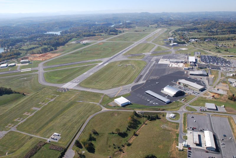
And an outdated real life shot of the airport.

 
Well, looks like I need to step up my game regarding the ground texturing. That look really good!
Thanks man! I put a lot of effort in to them and it took a long time to create them. But still, your textures look really amazing as well and you have the P3D abilities of using normal maps and stuff. I hope to be able to do the same some day.
 
Hey, I want to ask you :)

Did you needed an authorization to enter on the airport and take pictures?or i'st someone else who take pics for you?

or no need of authorization? :/
 
Hey, I want to ask you :)

Did you needed an authorization to enter on the airport and take pictures?or i'st someone else who take pics for you?

or no need of authorization? :/
Getting photos was pretty easy as arnobg works at the airport so he was able to do the photography.
 
thanks :) and for satelitte imagery?

you are using the USGS Opensource imagery?

Right now we are using free imagery to develop the airfield however, it won't be the imagery in the released product.

We are currently exploring different options as far as where we want to acquire the best and most recent imagery since there have been many recent changes to the airport layout. This obviously won't be free to develop.
 
I finished the model for the fire station and the terminal model is also nearly done. I started working on the cargo apron at the other end of the airport.

Fire Station
16260028473_2a1cd116c7_o.png


Cargo
16692621780_1ef77f762d_o.png


Progress is very fast and I only need to add a few more details and then the first models are ready for texturing.
 
Thank you! I use blender for modeling and Gimp for texturing. I also use Gmax for the ground polys as I own the fs2002 SDK and still use that method.
 
Looking good!!

Cargo ramps leading into the groung: How will this be placed in the sim?

Thanks man! I am still thinking about the cargo ramps as I haven't exported anything into the sim yet. I was thinking of using flattens at lower altitudes but I have no idea if that will work out or not.
 
I thought about this method aswell ;)
In order to avoid the ramp edges getting messed up with the ground poly I suggest to model the surrounding asphalt in this file, exporting seperately and using the exact same coordinates on placement.
 
I thought about this method aswell ;)
In order to avoid the ramp edges getting messed up with the ground poly I suggest to model the surrounding asphalt in this file, exporting seperately and using the exact same coordinates on placement.

Yes I was going to suggest this as well.
 
I thought about this method aswell ;)
In order to avoid the ramp edges getting messed up with the ground poly I suggest to model the surrounding asphalt in this file, exporting seperately and using the exact same coordinates on placement.
Thanks for the suggestion, I will try it out once I get to the point of exporting my models.
 
Hello Brianguy :)

I've choosen to switch to Blender (as a many people asked me :) and told me there are better tools and render (ambiant occlustion shadows etc) But, still fighting Blender :/

Are you able via PM, Skype or else to give me some help and support? :)

Thanks

Your KTRI scenery look Really awesome :), but, how did you make that pictures? (render, with photoreal etc :) it looks professionals :S

Grtz, Aviana Scener
 
Back
Top