• Which the release of FS2020 we see an explosition of activity on the forun and of course we are very happy to see this. But having all questions about FS2020 in one forum becomes a bit messy. So therefore we would like to ask you all to use the following guidelines when posting your questions:

    • Tag FS2020 specific questions with the MSFS2020 tag.
    • Questions about making 3D assets can be posted in the 3D asset design forum. Either post them in the subforum of the modelling tool you use or in the general forum if they are general.
    • Questions about aircraft design can be posted in the Aircraft design forum
    • Questions about airport design can be posted in the FS2020 airport design forum. Once airport development tools have been updated for FS2020 you can post tool speciifc questions in the subforums of those tools as well of course.
    • Questions about terrain design can be posted in the FS2020 terrain design forum.
    • Questions about SimConnect can be posted in the SimConnect forum.

    Any other question that is not specific to an aspect of development or tool can be posted in the General chat forum.

    By following these guidelines we make sure that the forums remain easy to read for everybody and also that the right people can find your post to answer it.

MSFS TIN exclusion Polygon

Christian Bahr

Resource contributor
Messages
951
Country
germany
Hi all,

i need some help

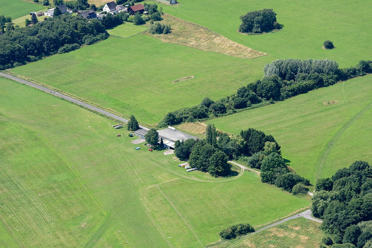
I am struggling with a problem and the problem is called Vector Data. On an airfield (EDIU) that I am working on there is a polygon with the property that it excludes the TIN below.

msfs_vector_data_type.jpg

The properties of the polygon: noTin airport airportSize=XS


msfs_vector_data_package_name.jpg

The debug mode shows that it is a polygon from the FS base: fs-base

The result is that my high-resolution 1m LIDAR Mesh does not come into play. The question that naturally arises is how to remove this polygon.

I am grateful for any help :)
 
Hi Christian:

Sorry, I do not have a "quick fix" for excluding the MSFS default airport flatten at this moment.

I do instead, have a few comments and questions as to how you plan to "terra-form" and blend this airport within your LiDAR data set. :scratchch


IIUC, you refer to this airport, which exists in MSFS, but not legacy versions of FS:


The EDIU RWYs IRL have a substantial slope downhill to the NE.

However, the MSFS default EDIU CVX vector Airport Boundary 'flatten' polygon:

[MSFS-2020_Packages_install path]\Official\OneStore\fs-base\scenery\0601\CVX5013.BGL


...when extracted to ESRI *.SHP via Patrick Germain's CvxExtractor, and then 'Appended' to SBuilderX, has:

* A assigned GUID {00000000-0000-0000-0000-000000000000} Vector Polygon Type-3 value: "Exclude_All_Terrain_Items"

* An assigned Altitude value of 0 Meters AMSL


...which IIUC, allows MSFS' internally-assigned attributes to determine:

* AB Polygon Texture

...and:

* RWY flattening (default is ARP elevation)


AFAIK, many airports in MSFS have been configured this way (to reduce workload making RWYs sloped along their axis ?)


IRL, grass RWYs are 'rolled' intensively to flatten the surface for aircraft wheels, even though RWYs may be sloped end-to-end.

This is particularly true with RWYs for Gliders, which may have smaller wheel diameters and relatively fragile construction


1 Meter LiDAR may create a rather "bumpy" surface for gliders to navigate.

Do you intend to "smooth" those sloped RWY surfaces ?

If so, do you also intend to enable A.I. / Ground Traffic which can actually operate on the sloped RWYs ?


You may note that currently one must decide either to make terrain polys in ADE_Alpha20 or MSFS SDK GUI :alert:

https://www.fsdeveloper.com/forum/t...the-air-terraform-question.451036/post-871022


If you were to create a terrain polygon in ADE you would see these options:

ediu_ade_alpha20_terrain_polygon_properties-1-jpg.76847


IIRC, the MSFS SDK GUI presents a similar set of options via its dialog boxes.


Since this scenario may likely involve terra-forming to impose a slope for your RWYs, I shall refer you initially to this info:


https://www.fsdeveloper.com/forum/threads/question-about-scenery-poly-exclude-all.452582/

https://www.fsdeveloper.com/forum/threads/problem-creating-airport-on-rough-land.449073/page-2

https://www.fsdeveloper.com/forum/threads/thoughts-on-modelling-a-large-non-flat-airport.450254/

https://docs.flightsimulator.com/html/index.htm#t=Content_Configuration/Environment/Airports_And_Facilities/Airport_Definition_Properties.htm&rhsearch=applyFlatten&rhhlterm=applyflatten

https://docs.flightsimulator.com/html/index.htm#t=Developer_Mode/Scenery_Editor/Objects/Rectangle_Objects.htm#h&rhsearch=sloped runway&rhhlterm=slope runway runways


I hope this info may help initially with planning your approach to the terrain configuration at this airfield. :)

GaryGB
 

Attachments

  • EDIU_ADE_Alpha20_Terrain_Polygon_Properties-1.jpg
    EDIU_ADE_Alpha20_Terrain_Polygon_Properties-1.jpg
    145.6 KB · Views: 532
Last edited:
Hi Garry, you can always be relied on :wave:

I think I got a little closer to the problem. As it currently looks, it is not due to the described polygon that excludes the TIN. It seems to be due to the runway, because if I play something with the parameters there, then my terrain is shown to me as it should be displayed.

The airfield should have a runway with a natural gradient, so it should not be flat. I am currently doing the main work of the airport attributes with the help of the MSFS built-in scenery editor. However, I have already downloaded and installed the latest version of the Airport Design Editor. There I had loaded the stock data of the MSFS for EDIU to see which files would be suitable for an error analysis. However, I did not get any further there.

Maybe it is a little more complicated than I suspected at the beginning when I wrote the LADAR data directly into the profile of the runway. Or it is the terraforming parameter of the runway itself that is causing the error. I am now experimenting a little further and when the occasion arises, I will report that here.

Thank you again for your assistance :)
 
Hi Gary, you can always be relied on :wave:

I think I got a little closer to the problem. As it currently looks, it is not due to the described polygon that excludes the TIN. It seems to be due to the runway, because if I play something with the parameters there, then my terrain is shown to me as it should be displayed.

The airfield should have a runway with a natural gradient, so it should not be flat. I am currently doing the main work of the airport attributes with the help of the MSFS built-in scenery editor. However, I have already downloaded and installed the latest version of the Airport Design Editor. There I had loaded the stock data of the MSFS for EDIU to see which files would be suitable for an error analysis. However, I did not get any further there.

Maybe it is a little more complicated than I suspected at the beginning when I wrote the LiDAR data directly into the profile of the runway. Or it is the terraforming parameter of the runway itself that is causing the error. I am now experimenting a little further and when the occasion arises, I will report that here.

Thank you again for your assistance :)

Ah yes, I think I recall now, how I did this months ago ...thanks to your mention of 'RWY parameters'. ;)

IIRC, setting a "Transparent" attribute for the RWY 'should' allow the underlying terrain mesh shape to be displayed properly. :wizard:


In ADE_20 Alpha-20 HF3 GUI:

ADE Menu > Lists > Runways > select: RWY # > [Edit] button > Properties > {Runway} tab > check: Transparency checkbox > [OK] button


In MSFS SDK:

https://docs.flightsimulator.com/html/index.htm#t=Developer_Mode/Scenery_Editor/Objects/Runway_Objects.htm

"The following options will be applied to the surface material, as well as any further materials you use (as explained below):
  • Transparent​

    Checking this will make the runway materials transparent so they won't be rendered in the scene, although the runway will still be valid and usable. Also note that even when a runway is flagged as transparent, its Markings will still be rendered."

https://docs.flightsimulator.com/html/index.htm#t=Content_Configuration/Environment/Airports_And_Facilities/Runway_Definition_Properties.htm&rhsearch=runway transparent&rhhlterm=runway runways transparent

AttributeDescriptionTypeRequired

transparentMake the runway surface transparent (TRUE) or not (FALSE).BooleanNo


GaryGB
 
Last edited:
Ah yes, I think I recall now, how I did this months ago ...thanks to your mention of 'RWY parameters'. ;)

IIRC, setting a "Transparent" attribute for the RWY 'should' allow the underlying terrain mesh shape to be displayed properly. :wizard:


In ADE_20 Alpha-20 HF3 GUI:

ADE Menu > Lists > Runways > select: RWY # > [Edit] button > Properties > {Runway} tab > check: Transparency checkbox > [OK] button


In MSFS SDK:

https://docs.flightsimulator.com/html/index.htm#t=Developer_Mode/Scenery_Editor/Objects/Runway_Objects.htm

"The following options will be applied to the surface material, as well as any further materials you use (as explained below):
  • Transparent​

    Checking this will make the runway materials transparent so they won't be rendered in the scene, although the runway will still be valid and usable. Also note that even when a runway is flagged as transparent, its Markings will still be rendered."

https://docs.flightsimulator.com/html/index.htm#t=Content_Configuration/Environment/Airports_And_Facilities/Runway_Definition_Properties.htm&rhsearch=runway transparent&rhhlterm=runway runways transparent

AttributeDescriptionTypeRequired

transparentMake the runway surface transparent (TRUE) or not (FALSE).BooleanNo


GaryGB
You're a legend Gary! Selflessly offering detailed support over the years. I just wanted to pop my head in and value your contribution. I have learnt alot from your knowledge sharing.

Sent from my SM-G998B using Tapatalk
 
Back
Top